Two Rivers Dam facts for kids
Quick facts for kids Two Rivers Dam |
|
|---|---|
|
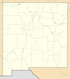
Location of Two Rivers Dam in New Mexico
|
|
| Country | United States |
| Location | Chaves County, New Mexico |
| Coordinates | 33°17′52″N 104°43′23″W / 33.29778°N 104.72306°W |
| Purpose | Flood control |
| Opening date | August, 1963 |
| Owner(s) | United States Army Corps of Engineers |
| Dam and spillways | |
| Type of dam | Embankment, earth-fill |
| Impounds | Hondo River & Rocky Arroyo |
| Height | 107 ft (33 m) |
| Length | 7,950 ft (2,420 m) |
| Width (base) | 600 ft (180 m) |
| Reservoir | |
| Normal elevation | 3,950 ft (1,200 m) AMSL |
The Two Rivers Dam is a special kind of dam in southeastern New Mexico. It sits about sixteen miles southwest of the city of Roswell. What makes it unique is that it's a "dry dam." This means it usually doesn't hold back water. Its main job is to stop floods.
The dam is actually made of two separate parts. These two parts are about 1.5 miles apart, with higher land between them. Normally, the rivers flow freely through the dam area. But when there's a lot of rain or snow melting, water can build up. This helps protect towns downstream from flooding. Sometimes, during spring, water collects behind the northern dam. This creates a small green area, like an oasis.
Both parts of the dam are built from earth. They have rough rocks on their outer surfaces. These rocks help stop the dam from wearing away. The very top of both dams is 4058 feet above sea level. During a big flood, each dam's reservoir holds water separately. But if the water gets high enough (4000 feet above sea level), the two reservoirs join together. They then form one very large body of water.
What is the Northern Dam Like?
The northern part of the Two Rivers Dam is also called the Diamond A dam. It's the first dam you might see. This section is 5000 feet long, which is almost a mile! It stands 95 feet tall. At its widest point at the bottom, it's 525 feet across. The top of the dam is 24 feet wide.
This northern dam crosses the Hondo River. At the bottom of the dam, there's a special gate. This gate can be closed to stop floodwaters from rushing downstream. Usually, the gate is left open. This allows the river to flow naturally. The gate is only closed when there's a risk of flooding. There's a two-lane gravel road across the top of this dam. It's open for people to use. You can cross this northern dam to reach the southern dam.
What is the Southern Dam Like?
The southern part of the Two Rivers Dam is known as the second dam. It's a bit shorter than the northern dam, at 2950 feet long. However, it's taller, standing 107 feet high. The base of this dam is 600 feet wide, and its top is 18 feet wide.
This dam crosses a stream called Rocky Arroyo. Rocky Arroyo is an "intermittent stream." This means water doesn't always flow through it. Because of this, the area behind the southern dam is usually much drier. It doesn't get as much water as the area behind the northern dam.
Why Was the Two Rivers Dam Built?
The city of Roswell faced serious floods many times. Big floods hit the city in 1937, 1941, and again in 1954. These floods caused a lot of damage. After the 1954 flood, the United States government decided to act.
In 1954, the US Congress passed a law called the Watershed Protection and Flood Prevention Act of 1954. This law allowed the Corps of Engineers to build dams. Their goal was to protect Roswell from future floods. The construction of the Two Rivers Dam was completed in 1963. It has been helping to control floods ever since.
 | Audre Lorde |
 | John Berry Meachum |
 | Ferdinand Lee Barnett |


