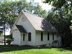
Union Chapel, Massachusetts facts for kids
Quick facts for kids
Union Chapel, Massachusetts
|
|
|---|---|
|
Village
|
|

750 Podunk Road
|
|
| Country | United States |
| State | Massachusetts |
| County | Worcester |
| Elevation | 745 ft (227 m) |
| Time zone | UTC-5 (Eastern (EST)) |
| • Summer (DST) | UTC-4 (EDT) |
| Area code(s) | 508 & 774 |
| GNIS feature ID | 609856 |
Union Chapel is a small village located in the town of East Brookfield. It is part of Worcester County in the state of Massachusetts, United States. Villages like Union Chapel are often quiet places where people live close to nature.
About Union Chapel
Union Chapel is known for its peaceful setting. It offers a glimpse into traditional New England village life. The village is a part of the larger East Brookfield community.
Where is it?
Union Chapel is found in the central part of Massachusetts. It is within Worcester County, which is one of the largest counties in the state. The village is located at an elevation of about 745 feet (227 meters) above sea level. This elevation can sometimes mean cooler temperatures and pretty views.
What's it like to live there?
Life in Union Chapel is often calm and community-focused. Residents enjoy the natural beauty of the area. It is a place where neighbors often know each other. The village provides a quiet escape from busy city life.
A Look at Its History
Like many places in Massachusetts, Union Chapel has a long history. It developed over time as part of the growth of East Brookfield. Villages often grew around important buildings, like churches or mills. Union Chapel likely got its name from a significant chapel or meeting house in the area. These places were central to early community life.


