Union Covered Bridge State Historic Site facts for kids
Quick facts for kids Union Covered Bridge State Historic Site |
|
|---|---|
 |
|
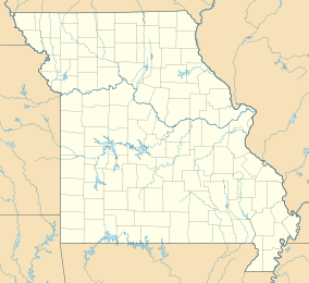
| Location | Monroe, Missouri, United States |
| Area | 1.24 acres (0.50 ha) |
| Elevation | 676 ft (206 m) |
| Established | 1967 |
| Governing body | Missouri Department of Natural Resources |
| Website | Union Covered Bridge State Historic Site |
|
Union Covered Bridge
|
|
| Nearest city | Paris, Missouri |
| Area | 9.9 acres (4.0 ha) |
| Built | 1870 |
| Built by | Elliot, Joseph C. |
| NRHP reference No. | 70000342 |
| Added to NRHP | June 15, 1970 |
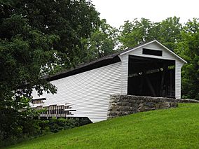
The Union Covered Bridge State Historic Site in Monroe County, Missouri, is a special place that protects an old, historic bridge. This bridge, called the Union Covered Bridge, was built way back in 1871. It crosses the Elk Fork of the Salt River. The bridge was an important link for the road between Paris and Fayette. Its name comes from a church that used to be nearby.
The Missouri Department of Natural Resources takes care of the site. The bridge has been repaired a few times over the years. It was added to the National Register of Historic Places in 1970.
Contents
What Makes This Bridge Special?
The Union Covered Bridge is a type of bridge called a Burr Arch span. It is about 120-foot-long (37 m). The bridge is also 17 feet 6 inches (5.33 m) wide and 12 feet (3.7 m) high.
How Was It Built?
A man named Joseph C. Elliot built the bridge in 1871. He used strong, local oak wood. The outside of the bridge is covered with wooden boards called clapboard. It also has a roof made of wood shingles.
The bridge is "covered" to protect its wooden parts from rain and snow. This helps the bridge last much longer. Before this bridge, two other uncovered bridges were built here. They wore out quickly because they were not protected from the weather.
History of the Bridge
The Union Covered Bridge has faced some challenges over the years.
Repairs and Restorations
In 1968, some repairs were done to the bridge. Parts from another covered bridge, the Mexico Covered Bridge, were used. That bridge had been destroyed by a flood the year before.
In 1970, the Union bridge had to close. This happened because heavy trucks drove over it and damaged its wooden parts. A big repair project was finished in 1988 to fix it completely.
Surviving a Flood
In 2008, the bridge was in danger from a very bad flood. To save it, some of the wooden siding near the bottom was removed. This allowed the floodwater to flow through the bridge's structure. It stopped the strong current from hitting the bridge directly. This smart move saved the bridge from being washed away. It was fully restored again in 2019.
 | Audre Lorde |
 | John Berry Meachum |
 | Ferdinand Lee Barnett |


