Upper Mississippi water resource region facts for kids
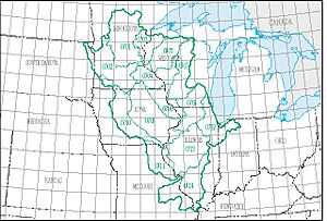
The Upper Mississippi water resource region is a big area of land that collects water, like a giant funnel. It's one of 21 main water regions in the United States. The United States Geological Survey (USGS) uses these regions to help study and manage water across the country. Each region includes the area where a major river, or several rivers, drain their water.
This Upper Mississippi region has a special code, 07. It covers about 189,968 square miles (492,010 square kilometers) of land. This huge area is divided into 14 smaller parts, called subregions. These subregions have codes from 0701 to 0714.
This region includes the Mississippi River Basin above where it meets the Ohio River. It does not include the Missouri River Basin. You can find parts of this region in many states, including Illinois, Indiana, Iowa, Michigan, Minnesota, Missouri, South Dakota, and Wisconsin.
Exploring the Upper Mississippi Water Region
This section helps us understand the different parts of the Upper Mississippi water region. Each part is called a subregion. They are all important for how water flows through the land.
What are Water Subregions?
Water subregions are like smaller neighborhoods within a big city. Each one collects water for a specific part of the river system. Scientists use these areas to study how water moves and where it goes.
Meet the Subregions
Here is a list of the 14 subregions that make up the Upper Mississippi water resource region. Each one has its own unique features and location.
| Subregion Code | Subregion Name | What it Includes | Where it Is | Size (square miles) | Map |
|---|---|---|---|---|---|
| 0701 | Mississippi Headwaters Subregion | This is where the Mississippi River begins. It includes the river basin before the St. Croix River joins it. | Located in Minnesota. | 20,200 sq mi (52,000 km2) | |
| 0702 | Minnesota Subregion | This subregion covers the entire Minnesota River Basin. | Located in Iowa, Minnesota, and South Dakota. | 16,800 sq mi (44,000 km2) | |
| 0703 | St. Croix Subregion | This area includes the St. Croix River Basin. | Located in Minnesota and Wisconsin. | 7,750 sq mi (20,100 km2) | |
| 0704 | Upper Mississippi–Black–Root Subregion | This part of the Mississippi River Basin is below the St. Croix River. It includes the Root River Basin and the La Crosse River Basin. | Located in Iowa, Minnesota, and Wisconsin. | 10,700 sq mi (28,000 km2) | |
| 0705 | Chippewa Subregion | This subregion covers the Chippewa River Basin. | Located in Michigan and Wisconsin. | 9,570 sq mi (24,800 km2) | |
| 0706 | Upper Mississippi–Maquoketa–Plum Subregion | This part of the Mississippi River Basin is below the Root and La Crosse River Basins, up to Lock and Dam 13. | Located in Illinois, Iowa, Minnesota, and Wisconsin. | 8,610 sq mi (22,300 km2) | |
| 0707 | Wisconsin Subregion | This subregion includes the Wisconsin River Basin. | Located in Michigan and Wisconsin. | 11,900 sq mi (31,000 km2) | |
| 0708 | Upper Mississippi–Iowa–Skunk–Wapsipinicon Subregion | This part of the Mississippi River Basin is below Lock and Dam 13, up to the Des Moines River Basin. | Located in Illinois, Iowa, and Michigan. | 22,800 sq mi (59,000 km2) | |
| 0709 | Rock Subregion | This subregion covers the Rock River Basin. | Located in Illinois and Wisconsin. | 10,900 sq mi (28,000 km2) | |
| 0710 | Des Moines Subregion | This subregion includes the Des Moines River Basin. | Located in Iowa, Minnesota, and Missouri. | 14,400 sq mi (37,000 km2) | |
| 0711 | Upper Mississippi–Salt Subregion | This part of the Mississippi River Basin is below the Des Moines River Basin, up to the Missouri River Basin. | Located in Illinois, Iowa, and Missouri. | 9,970 sq mi (25,800 km2) | |
| 0712 | Upper Illinois Subregion | This subregion covers the Illinois River Basin, including the Fox River Basin. | Located in Illinois, Indiana, Michigan, and Wisconsin. | 10,900 sq mi (28,000 km2) | |
| 0713 | Lower Illinois Subregion | This subregion includes the Illinois River Basin below where the Fox River joins it. | Located in Illinois. | 17,700 sq mi (46,000 km2) | |
| 0714 | Upper Mississippi–Kaskaskia–Meramec Subregion | This part of the Mississippi River Basin is below the Missouri River Basin, up to the Ohio River. | Located in Illinois and Missouri. | 11,200 sq mi (29,000 km2) |
 | Percy Lavon Julian |
 | Katherine Johnson |
 | George Washington Carver |
 | Annie Easley |


