Urbancrest, Ohio facts for kids
Quick facts for kids
Urbancrest, Ohio
|
|
|---|---|
|
Village
|
|

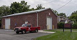
Urbancrest Maintenance Facilities
|
|

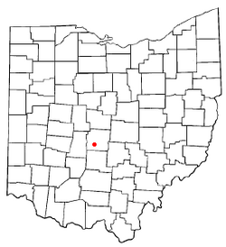
Location of Urbancrest, Ohio
|
|

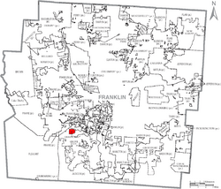
Location of Urbancrest within Franklin County
|
|
| Country | United States |
| State | Ohio |
| County | Franklin |
| Area | |
| • Total | 0.59 sq mi (1.52 km2) |
| • Land | 0.59 sq mi (1.52 km2) |
| • Water | 0.00 sq mi (0.00 km2) |
| Elevation | 830 ft (250 m) |
| Population
(2020)
|
|
| • Total | 1,031 |
| • Density | 1,759.39/sq mi (679.44/km2) |
| Time zone | UTC-5 (Eastern (EST)) |
| • Summer (DST) | UTC-4 (EDT) |
| ZIP code |
43123
|
| Area code(s) | 614 |
| FIPS code | 39-79100 |
| GNIS feature ID | 2400032 |
Urbancrest is a small village located in Franklin County, Ohio, in the United States. In 2020, about 1,031 people lived there. It's part of the South-Western City Schools District.
Contents
Geography and Location
Urbancrest is a small village. It covers an area of about 0.60 square miles (1.52 square kilometers). All of this area is land.
Urbancrest is located right next to two larger cities: Columbus, Ohio and Grove City, Ohio. The entire village is within the South-Western City School District. This means all students living in Urbancrest go to schools in this district.
History of Urbancrest
Urbancrest has an interesting history. People first settled here in 1889. One of the first important buildings was a church. This church was founded in 1892 and later became known as Union Baptist Church.
The village officially became a town, or "incorporated," in 1948. A big moment in its history happened in 1971. That year, Ellen Walker Craig-Jones was elected as mayor. She made history by becoming the first African-American woman to be elected mayor in the entire United States of America.
Population and People
| Historical population | |||
|---|---|---|---|
| Census | Pop. | %± | |
| 1950 | 823 | — | |
| 1960 | 1,029 | 25.0% | |
| 1970 | 754 | −26.7% | |
| 1980 | 880 | 16.7% | |
| 1990 | 862 | −2.0% | |
| 2000 | 868 | 0.7% | |
| 2010 | 960 | 10.6% | |
| 2020 | 1,031 | 7.4% | |
| U.S. Decennial Census 2020 | |||
The number of people living in Urbancrest has changed over the years. In 1950, there were 823 residents. By 2020, the population had grown to 1,031 people. This shows a steady increase in the number of people calling Urbancrest home.
Who Lives in Urbancrest?
The 2020 census gives us a picture of the people living in Urbancrest.
- About 58% of the residents are Black or African American.
- Around 25% are White.
- About 8.6% of the population is Hispanic or Latino. This group can be of any race.
- The remaining residents belong to other racial groups or are of mixed race.
In 2010, the average age of people in Urbancrest was 25.3 years old. A large part of the population, about 38%, was under 18 years old. This means Urbancrest is a community with many young people and families. Most households had children living in them. The village also had more females than males.
See also
 In Spanish: Urbancrest (Ohio) para niños


