Urbanna Creek facts for kids
Quick facts for kids Urbanna Creek |
|
|---|---|

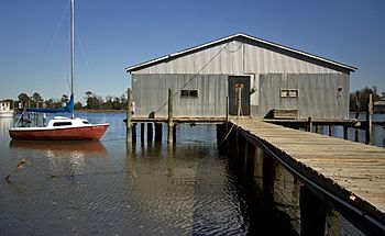
Urbanna Creek in Urbanna, Virginia
|
|
|
Location of Urbanna Creek mouth
|
|
| Other name(s) | Tributary to Rappahannock River |
| Country | United States |
| State | Virginia |
| County | Middlesex |
| City | Urbanna |
| Physical characteristics | |
| Main source | Dam at Town Bridge Pond about 0.5 miles southwest of Urbanna, Virginia 0 ft (0 m) 37°38′06″N 076°35′57″W / 37.63500°N 76.59917°W |
| River mouth | Rappahannock River Urbanna, Virginia 0 ft (0 m) 37°38′30″N 076°34′04″W / 37.64167°N 76.56778°W |
| Length | 3.52 mi (5.66 km) |
| Basin features | |
| Progression | southeast then northeast |
| River system | Rappahannock River |
| Basin size | 9.69 square miles (25.1 km2) |
| Tributaries |
|
| Waterbodies | Town Bridge Pond |
| Bridges | Town Bridge Road, Urbanna Road |
Urbanna Creek is a small waterway in Middlesex County, Virginia. It flows for about 3.52 mi (5.66 km) before joining the larger Rappahannock River. What's special about Urbanna Creek is that it's a tidal stream along its whole length. This means its water level goes up and down with the ocean tides.
Contents
What's in a Name?
Urbanna Creek has had a couple of other names over time. Historically, people have also called it:
- Nimcock Creek
- Urbana Creek
Where Does Urbanna Creek Flow?
Urbanna Creek starts at a dam located at Town Bridge Pond. This spot is about half a mile southwest of the town of Urbanna, Virginia. From there, the creek first flows towards the southeast. Then, it changes direction and heads northeast. Finally, it reaches its end point, joining the Rappahannock River right in Urbanna, Virginia.
The Land Around the Creek
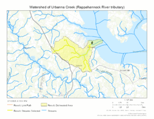
The area that drains into Urbanna Creek is called its watershed. This watershed covers about 9.69 square miles (25.1 km2) of land. Every year, this area gets about 45.8 inches of rain. A good portion of the land, about 54.8%, is covered by forests. These forests help keep the water clean and provide homes for wildlife.
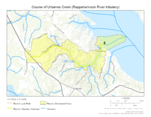
Seeing the Creek on a Map
Maps can help us understand where Urbanna Creek is and how it flows.
 | Aaron Henry |
 | T. R. M. Howard |
 | Jesse Jackson |


