
Urrao facts for kids
Quick facts for kids
Urrao, Antioquia
|
||
|---|---|---|
|
Municipality & Town
|
||
.jpg)
Panorámica de Urrao.
|
||
|
||

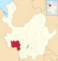
Location of the municipality of Urrao, Antioquia in the Antioquia Department of Colombia
|
||

Urrao, Antioquia
Location in Colombia
|
||
| Country | ||
| Department | ||
| Subregion | Southwestern | |
| Founded | June 12 of 1781 | |
| Area | ||
| • Municipality & Town | 2,556 km2 (987 sq mi) | |
| Elevation | 1,830 m (6,004 ft) | |
| Population
(2015)
|
||
| • Municipality & Town | 44,648 | |
| • Urban | 17,401 | |
| • Metro density | 17.47/km2 (45.2/sq mi) | |
| Demonym(s) | Urraeño, -a | |
| Time zone | UTC-5 (Colombia Standard Time) | |
| Website | http://www.urrao-antioquia.gov.co | |

Urrao is a town and a municipality in Colombia. A municipality is like a local government area that includes a main town and the surrounding countryside. Urrao is located in the southwest part of the Antioquia region.
It shares its borders with several other towns. To the north, it's next to Frontino and Abriaquí. To the east, you'll find Abriaquí, Caicedo, Anzá, Betulia, and Salgar. To the south and west, it borders Vigía del Fuerte and the Chocó region.
Urrao is the second largest municipality in the Antioquia department by land area. In 2015, about 44,648 people lived there. A famous professional cyclist, Rigoberto Urán, was born and grew up in Urrao.
What is the Climate Like in Urrao?
The climate in Urrao is generally warm and mild. It rains a lot throughout the year, even during the drier months. This type of climate is known as Cfb, according to the Köppen and Geiger climate classification system.
The average temperature in Urrao is around 15.7 °C (60.3 °F). Each year, about 7573 mm (298.1 inches) of rain falls. This means Urrao is a very wet place!
| Climate data for Urrao, elevation 1,850 m (6,070 ft), (1981–2010) | |||||||||||||
|---|---|---|---|---|---|---|---|---|---|---|---|---|---|
| Month | Jan | Feb | Mar | Apr | May | Jun | Jul | Aug | Sep | Oct | Nov | Dec | Year |
| Mean daily maximum °C (°F) | 22.7 (72.9) |
23.0 (73.4) |
23.0 (73.4) |
22.7 (72.9) |
22.5 (72.5) |
22.7 (72.9) |
22.9 (73.2) |
23.0 (73.4) |
22.5 (72.5) |
21.9 (71.4) |
21.7 (71.1) |
22.0 (71.6) |
22.5 (72.5) |
| Daily mean °C (°F) | 17.3 (63.1) |
17.4 (63.3) |
17.6 (63.7) |
17.6 (63.7) |
17.6 (63.7) |
17.6 (63.7) |
17.5 (63.5) |
17.5 (63.5) |
17.2 (63.0) |
17.0 (62.6) |
17.1 (62.8) |
17.2 (63.0) |
17.4 (63.3) |
| Mean daily minimum °C (°F) | 12.9 (55.2) |
13.3 (55.9) |
13.4 (56.1) |
13.9 (57.0) |
14.1 (57.4) |
13.8 (56.8) |
13.4 (56.1) |
13.3 (55.9) |
13.4 (56.1) |
13.3 (55.9) |
13.5 (56.3) |
13.4 (56.1) |
13.5 (56.3) |
| Average precipitation mm (inches) | 119.0 (4.69) |
113.2 (4.46) |
133.8 (5.27) |
199.4 (7.85) |
249.7 (9.83) |
182.5 (7.19) |
171.9 (6.77) |
170.6 (6.72) |
223.6 (8.80) |
295.8 (11.65) |
251.7 (9.91) |
162.8 (6.41) |
2,273.9 (89.52) |
| Average precipitation days (≥ 1.0 mm) | 13 | 12 | 14 | 19 | 22 | 18 | 17 | 18 | 21 | 24 | 22 | 17 | 217 |
| Average relative humidity (%) | 88 | 88 | 88 | 88 | 88 | 88 | 88 | 87 | 89 | 89 | 89 | 89 | 88 |
| Mean monthly sunshine hours | 179.8 | 158.1 | 158.1 | 126.0 | 136.4 | 159.0 | 176.7 | 170.5 | 132.0 | 127.1 | 132.0 | 155.0 | 1,810.7 |
| Mean daily sunshine hours | 5.8 | 5.6 | 5.1 | 4.2 | 4.4 | 5.3 | 5.7 | 5.5 | 4.4 | 4.1 | 4.4 | 5.0 | 5.0 |
| Source: Instituto de Hidrologia Meteorologia y Estudios Ambientales | |||||||||||||
| Climate data for Urrao (Honda La), elevation 1,850 m (6,070 ft), (1981–2010) | |||||||||||||
|---|---|---|---|---|---|---|---|---|---|---|---|---|---|
| Month | Jan | Feb | Mar | Apr | May | Jun | Jul | Aug | Sep | Oct | Nov | Dec | Year |
| Mean daily maximum °C (°F) | 21.6 (70.9) |
21.8 (71.2) |
21.6 (70.9) |
21.6 (70.9) |
21.9 (71.4) |
21.7 (71.1) |
21.7 (71.1) |
21.9 (71.4) |
21.4 (70.5) |
21.2 (70.2) |
21.0 (69.8) |
21.0 (69.8) |
21.6 (70.9) |
| Daily mean °C (°F) | 16.6 (61.9) |
16.7 (62.1) |
16.9 (62.4) |
17.0 (62.6) |
17.1 (62.8) |
16.9 (62.4) |
16.8 (62.2) |
16.8 (62.2) |
16.6 (61.9) |
16.5 (61.7) |
16.7 (62.1) |
16.5 (61.7) |
16.8 (62.2) |
| Mean daily minimum °C (°F) | 12.1 (53.8) |
12.5 (54.5) |
12.8 (55.0) |
13.1 (55.6) |
12.9 (55.2) |
12.6 (54.7) |
12.7 (54.9) |
12.7 (54.9) |
12.6 (54.7) |
12.6 (54.7) |
12.7 (54.9) |
12.3 (54.1) |
12.7 (54.9) |
| Average precipitation mm (inches) | 63.5 (2.50) |
74.3 (2.93) |
94.8 (3.73) |
151.8 (5.98) |
182.5 (7.19) |
160.4 (6.31) |
158.9 (6.26) |
134.9 (5.31) |
208.5 (8.21) |
207.2 (8.16) |
184.5 (7.26) |
109.2 (4.30) |
1,698.1 (66.85) |
| Average precipitation days (≥ 1.0 mm) | 16 | 15 | 19 | 22 | 24 | 21 | 21 | 20 | 23 | 23 | 23 | 19 | 241 |
| Average relative humidity (%) | 91 | 91 | 91 | 91 | 91 | 91 | 91 | 91 | 92 | 92 | 91 | 92 | 91 |
| Mean monthly sunshine hours | 164.3 | 141.2 | 124.0 | 108.0 | 117.8 | 117.0 | 139.5 | 145.7 | 114.0 | 117.8 | 120.0 | 139.5 | 1,548.8 |
| Mean daily sunshine hours | 5.3 | 5.0 | 4.0 | 3.6 | 3.8 | 3.9 | 4.5 | 4.7 | 3.8 | 3.8 | 4.0 | 4.5 | 4.2 |
| Source: Instituto de Hidrologia Meteorologia y Estudios Ambientales | |||||||||||||
Images for kids
-

Panorámica de Urrao.
-

Flag of Urrao.
-
Location of the municipality of Urrao, Antioquia in the Antioquia Department of Colombia.
See also
 In Spanish: Urrao para niños
