Uttarakhand facts for kids
Quick facts for kids
Uttarakhand
उत्तरखन्द्
उत्तराखण्ड |
|
|---|---|
|
State of India
|
|
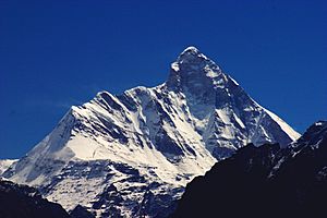
Nanda Devi, National Mountain of India
|
|
| Nickname(s):
"Devabhumi" (literally "Land of the Gods")
|
|
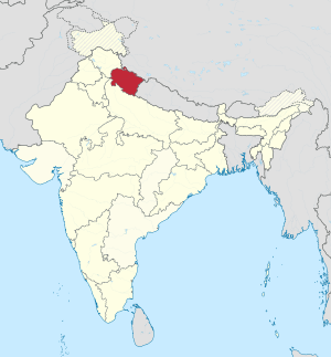
A map showing where Uttarakhand is in the Republic of India
|
|
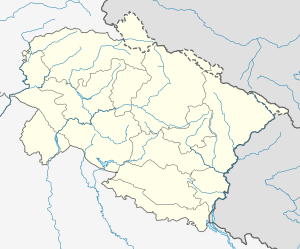
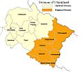
Map of Uttarakhand
|
|
| Country | |
| Region | North India |
| Area | |
| • Total | 56,019 km2 (21,629 sq mi) |
| Population
(2011)
|
|
| • Total | 10,116,752 |
| Time zone | UTC+05:30 (IST) |
| Official languages | Hindi · Sanskrit |
Uttarakhand is a beautiful state located in northern India. From 2000 to 2006, it was known as Uttaranchal. The name Uttarakhand comes from Sanskrit. It means "Northern Country" or "Northern Land". This state is famous for its stunning mountains. It is often called "Devabhumi," which means "Land of the Gods."
Uttarakhand is home to over 10 million people, based on the 2011 census. It covers an area of about 56,019 square kilometers (21,629 square miles). The state is known for its high peaks and beautiful natural scenery. It is part of the North Indian region.
Symbols of Uttarakhand
Every state in India has its own special symbols. These symbols represent the unique nature and culture of the state. Uttarakhand also has its own provincial symbols. They include a bird, an animal, a tree, and a flower. These symbols show the rich wildlife and plant life found in the region.
Images for kids
-
Bal Mithai, a popular sweet from Kumaon
-
Pilgrims gather for the third Shahi Snan ("royal bath") at Har Ki Pauri in Haridwar, Uttarakhand on 14 April 2010 during Haridwar Kumbh Mela.
-
Jolly Grant Airport, Dehradun
-
Rajiv Gandhi International Cricket Stadium in Dehradun.
-
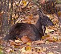
Alpine Musk Deer (Moschus chrysogaster)
-
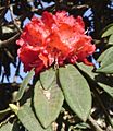
Burans (Rhododendron arboreum)
-
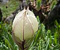
Kandali (Urtica dioica)
See also
 In Spanish: Uttarakhand para niños
 | James Van Der Zee |
 | Alma Thomas |
 | Ellis Wilson |
 | Margaret Taylor-Burroughs |


