Wahak Hotrontk, Arizona facts for kids
Quick facts for kids
Wahak Hotrontk, Arizona
|
|
|---|---|

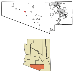
Location of Wahak Hotrontk in Pima County, Arizona.
|
|
| Country | United States |
| State | Arizona |
| County | Pima |
| Area | |
| • Total | 1.54 sq mi (3.99 km2) |
| • Land | 1.54 sq mi (3.99 km2) |
| • Water | 0.00 sq mi (0.00 km2) |
| Elevation | 1,939 ft (591 m) |
| Population
(2020)
|
|
| • Total | 88 |
| • Density | 57.11/sq mi (22.05/km2) |
| Time zone | UTC-7 (Mountain (MST)) |
| ZIP code |
85634
|
| Area code(s) | 520 |
| GNIS feature ID | 13276 |
Wahak Hotrontk, also called San Simon, is a small community in Pima County, Arizona. Its name in the O'odham language means "Road Dips." In 2020, about 120 people lived here.
This community is a census-designated place (CDP). This means it is an area that looks like a town but does not have its own local government. Wahak Hotrontk is located on the Tohono O'odham Nation reservation. It sits along Arizona State Route 86.
Contents
Where is Wahak Hotrontk?
Wahak Hotrontk is located in Pima County, Arizona. The community covers about 1.54 square miles (3.99 square kilometers) of land. There is no water area within its borders.
On the west side of the community, you can find important places. These include the San Simon Health Clinic. There is also the Tohono O'odham High School. A convenience store and gas station recently opened nearby.
People Living in Wahak Hotrontk
In 2020, the community had 120 people living there. These people lived in 35 different homes. About 22 of these homes were families.
The population density was about 78 people per square mile. This means the area is not very crowded. There were 48 housing units in total. The average income for a household was $22,683. The average income per person was $13,577.
Population Changes Over Time
The number of people living in Wahak Hotrontk has changed over the years.
| Historical population | |||
|---|---|---|---|
| Census | Pop. | %± | |
| 2020 | 88 | — | |
| U.S. Decennial Census | |||
Learning in Wahak Hotrontk
Students in Wahak Hotrontk go to schools in the Indian Oasis-Baboquivari Unified School District. This school district serves several communities in the area.
See also
 In Spanish: Wahak Hotrontk para niños


