Walkertown, North Carolina facts for kids
Quick facts for kids
Walkertown, North Carolina
|
|
|---|---|

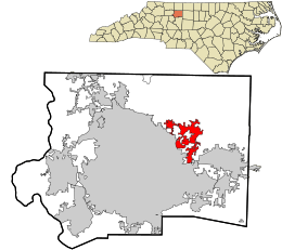
Location in Forsyth County and the state of North Carolina
|
|
| Country | United States |
| State | North Carolina |
| County | Forsyth |
| Incorporated | 1984 |
| Named for | Robert Walker |
| Area | |
| • Total | 6.72 sq mi (17.40 km2) |
| • Land | 6.70 sq mi (17.35 km2) |
| • Water | 0.02 sq mi (0.05 km2) |
| Elevation | 896 ft (273 m) |
| Population
(2020)
|
|
| • Total | 5,692 |
| • Density | 849.81/sq mi (328.09/km2) |
| Time zone | UTC-5 (Eastern (EST)) |
| • Summer (DST) | UTC-4 (EDT) |
| ZIP code |
27051
|
| Area code(s) | 336 |
| FIPS code | 37-70660 |
| GNIS feature ID | 2406821 |
Walkertown is a town located in Forsyth County, North Carolina, in the United States. It is a smaller community found just outside of the larger city of Winston-Salem. Walkertown is part of an area known as the Piedmont Triad. In 2020, about 5,695 people lived there.
Contents
Where is Walkertown Located?
Walkertown is in the eastern part of Forsyth County. It shares a border with the city of Winston-Salem to its southwest.
Main Roads in Walkertown
Several important roads pass through or near Walkertown. U.S. Route 311 goes right through the center of town. U.S. Route 158 runs through the southeastern part. Both of these highways lead southwest about 8 miles (13 km) to downtown Winston-Salem.
US 311 continues north-northeast to Madison, which is about 22 miles (35 km) away. US 158 goes east-northeast for about 33 miles (53 km) to Reidsville. North Carolina Highway 66 crosses both of these highways. It leads northwest about 10 miles (16 km) to Rural Hall.
A future highway, Interstate 74, is currently called NC Highway 74. This road goes around most of the town to the south. It runs parallel to NC 66. Both of these highways connect Walkertown to Kernersville to the southeast and Rural Hall to the northwest.
Land and Water Area
The United States Census Bureau says that Walkertown covers a total area of about 17.1 square kilometers (6.6 square miles). A very small part of this area, about 0.5 square kilometers (0.2 square miles), is water. This means most of Walkertown is land.
Who Lives in Walkertown?
| Historical population | |||
|---|---|---|---|
| Census | Pop. | %± | |
| 1990 | 1,200 | — | |
| 2000 | 4,009 | 234.1% | |
| 2010 | 4,675 | 16.6% | |
| 2020 | 5,695 | 21.8% | |
| 2021 (est.) | 5,781 | 23.7% | |
| U.S. Decennial Census | |||
The number of people living in Walkertown has grown over the years. In 1990, there were about 1,200 residents. By 2020, the population had increased to 5,692 people.
Walkertown's Population in 2020
In 2020, there were 5,692 people living in Walkertown. These people lived in 2,052 households. About 1,486 of these households were families.
| Group | Number | Percentage |
|---|---|---|
| White (not Hispanic or Latino) | 3,916 | 68.8% |
| Black or African American (not Hispanic or Latino) | 983 | 17.27% |
| Native American | 18 | 0.32% |
| Asian | 51 | 0.9% |
| Pacific Islander | 2 | 0.04% |
| Other/Mixed | 258 | 4.53% |
| Hispanic or Latino | 464 | 8.15% |
History of Walkertown
Walkertown got its name from a person named Robert Walker. He lived in the area as early as 1771. Even though Robert Walker later moved away, his home stayed standing for a long time. The town of Walkertown officially became a town in 1984.
The Thomas A. Crews House is an important historical building in Walkertown. It was added to the National Register of Historic Places in 1993. This means it is recognized as a place important to the history of the United States.
Famous People from Walkertown
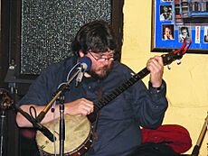
- Riley Baugus is a well-known musician. He plays old-time music, which is a traditional style of American folk music. He is from Walkertown.
See also
 In Spanish: Walkertown (Carolina del Norte) para niños
 | Precious Adams |
 | Lauren Anderson |
 | Janet Collins |


