Wallace River (Nova Scotia) facts for kids
Quick facts for kids Wallace |
|
|---|---|
|
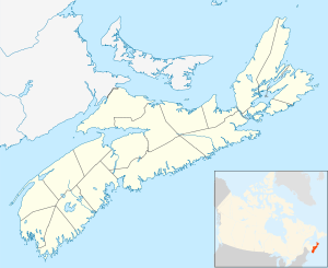
Location of the mouth of the Wallace River
|
|
| Country | Canada |
| Province | Nova Scotia |
| Physical characteristics | |
| Main source | Dicks Meadows Cobequid Mountains 350 m (1,150 ft) 45°33′25.50″N 63°34′1.78″W / 45.5570833°N 63.5671611°W |
| River mouth | Wallace Bay Wallace Bridge 0 m (0 ft) 45°48′47.7252″N 63°30′57.89″W / 45.813257000°N 63.5160806°W |
| Length | 45.5 km (28.3 mi) |
| Basin features | |
| Basin size | 394 km2 (152 sq mi) |
The Wallace River is a river located in Nova Scotia, Canada. It flows mainly through Cumberland County. This river is an important natural feature of the area.
Exploring the Wallace River
The Wallace River is about 45.5 kilometers (28 miles) long. That's like driving for almost half an hour! It starts high up in the Cobequid Mountains. These mountains are a beautiful part of Nova Scotia.
Journey of the River
The river begins its journey in a place called Dicks Meadows. This is where the first tiny streams come together. From there, the water flows downhill, gaining speed and size.
From Mountains to the Sea
As the Wallace River travels, it passes through different landscapes. It collects water from an area of about 394 square kilometers (152 square miles). Finally, the river reaches its end at Wallace Bay. This bay is near a place called Wallace Bridge. At this point, the river's water mixes with the salty water of the ocean.
 | Ernest Everett Just |
 | Mary Jackson |
 | Emmett Chappelle |
 | Marie Maynard Daly |


