Walls del Arrabal facts for kids
The Walls del Arrabal were old walls that once stood around the city of Madrid, the capital of Spain. They were the third set of five main walls built over time to protect the city. Today, no parts of these walls remain.
Historians are not completely sure when they were built or how far they stretched. Some think they might have been built as early as the 12th century. However, it is most likely that they were built in 1438. One important reason for building them was to protect people from serious diseases, like the plague, that were affecting the city. These walls helped connect the growing areas outside the main city and stopped sick people from entering.
The Walls del Arrabal were an expansion of the Christian Walls of Madrid. These Christian walls were built between the 11th and 12th centuries. Later, around 1566, the Walls of Philip II were built, making Madrid even more protected.
Madrid's Growing Walls

Madrid started as a Muslim fort in the 9th century. It was protected by the Muslim Walls of Madrid. After the Christian armies took control, new walls were added. These were the Christian Walls of Madrid, built in the 11th and 12th centuries. They helped protect the new parts of the city.
Madrid kept growing towards the east. The number of people living there increased a lot. From the mid-1400s to the early 1500s, the population grew from 5,000 to 12,000. Even though Madrid was still small, it was an important city in the old region of Castile. It was one of the few cities where important meetings were held.
What Were the Arrabales?
The areas outside the main city walls were called arrabales. This word means "suburbs." These suburbs got their names from churches and convents built there. For example, the Arrabal de San Martín was named after the Convent of San Martín. Another was San Ginés, named after the Church of San Ginés de Arlés.
Some historians believe the Walls del Arrabal were built in the mid-12th century. They think King Henry IV of Castile might have ordered them. It's possible that some suburbs had their own smaller walls at different times. For instance, San Martín and Santo Domingo might have had their own defenses.
However, many experts believe the walls were built later. Professor Montero Vallejo suggests they were built in 1438. This happened during the rule of King John II of Castile. He says the walls were built for two main reasons. First, for better city management. Second, to deal with a terrible plague that hit Madrid in the 15th century. This new wall surrounded all the suburbs, including Santa Cruz and San Millan. A hospital for plague victims, called Del Buen Suceso, was built outside the walls. It faced the area known today as Puerta del Sol. This hospital closed in 1854.
The Walls del Arrabal started near a gate called Puerta Cerrada. They then went around streets and squares that are still famous today. These include Calle Concepción Jerónima, Plaza de Jacinto Benavente, Calle Carretas, Puerta del Sol, Calle Preciados, Plaza de Santo Domingo, and Plaza de Isabel II.
Later, around 1520, the southern part of the wall was made even longer. This was to include more of the growing city. This extension started from the Puerta de Moros. It followed the paths of today's streets like San Millán and Duque de Alba.
Gates of the Walls
By the early 1500s, the Walls del Arrabal protected an area of about 70 hectares (about 173 acres). They had eight main gates and smaller openings called "postigos." These gates controlled who could enter and leave the city.
Here are some of the gates:
- Puerta de la Vega – This gate was a leftover from the older Muslim Walls of Madrid.
- Puerta de Moros – This gate was also part of the earlier Christian Walls of Madrid.
- Puerta de la Latina – This gate was originally on the road to Toledo. It was later moved to the Plaza de la Cebada.
- Postigo de San Millán – This smaller gate was near today's Plaza de Cascorro. It was named after a nearby small church.
- Puerta de Atocha – This gate was in the area of today's Plaza de Jacinto Benavente. It led to fields of a type of grass called esparto.
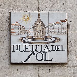
- Puerta del Sol – This famous gate was in the area now known as the Plaza de la Puerta del Sol. It was taken down in the mid-1500s. Its name, "Gate of the Sun," came from its front facing east, towards the sunrise.
- Postigo de San Martín – This smaller gate was first located where Calle San Martín and Calle Navas de Tolosa meet. It was later moved to what is now Plaza del Callao. It was named after a nearby convent.
- Puerta de Santo Domingo – This gate was in today's Plaza de Santo Domingo. It was the way out to towns like Hortaleza and the mountains of the Sierra de Guadarrama. It was named after the nearby Santo Domingo el Real convent.
Sadly, none of these walls or gates remain today.
See also
 In Spanish: Cerca del Arrabal para niños


