Walnut, North Carolina facts for kids
Quick facts for kids
Walnut
|
|
|---|---|
| Country | United States |
| State | North Carolina |
| County | Madison County |
| Elevation | 1,946 ft (593 m) |
| Time zone | UTC-5 (Eastern (EST)) |
| • Summer (DST) | UTC-4 (EDT) |
| ZIP code |
28753
|
| Area code(s) | 828 |
| GNIS feature ID | 1023108 |
Walnut is a small place located in Madison County, North Carolina, in the United States. It is known as an unincorporated community. This means it's a group of homes and businesses that don't have their own local government, like a mayor or city council. Instead, the county government helps manage the area.
Walnut gets its name from the nearby Walnut Mountains. These mountains are located further north from the community.
Contents
Where is Walnut Located?
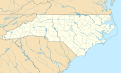
Walnut is found in the western part of North Carolina. It is part of Madison County. The community is about 1,946 feet (593 meters) above sea level.
Getting Around Walnut
The main road in Walnut is Barnard Road, also known as SR 1151. You can reach Walnut by taking NC 213 or Walnut Drive (SR 1439). These roads connect to larger highways like US 25 and US 70.
Nearby Towns and Cities
Walnut is located northwest of a town called Marshall. It is also considered part of the larger Asheville Metropolitan Statistical Area. This means it's near the city of Asheville and is connected to its economy and community.
What is an Unincorporated Community?
An unincorporated community is a place where people live together, but it doesn't have its own official city or town government. For example, it won't have its own mayor or city council. Instead, the local county government provides services like roads, police, and fire protection. This is different from a city, which has its own elected leaders and local laws.
 | Aaron Henry |
 | T. R. M. Howard |
 | Jesse Jackson |


