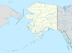
Ward Cove, Alaska facts for kids
Quick facts for kids
Ward Cove, Alaska
|
|
|---|---|
| Country | United States |
| State | Alaska |
| Borough | Ketchikan Gateway |
| Elevation | 164 ft (50 m) |
| Time zone | UTC-9 (Alaska (AKST)) |
| • Summer (DST) | UTC-8 (AKDT) |
| ZIP code |
99928
|
| GNIS feature ID | 1415612 |
Ward Cove is a small community located in Ketchikan Gateway Borough, Alaska, United States. It is known as an unincorporated community, which means it doesn't have its own local government like a city does. Instead, it's part of the larger borough.
This community is sometimes called by other names like Wacker, Wacker City, or Wards Cove. It sits about 164 feet (50 meters) above sea level. Ward Cove has its own post office and a ZIP code of 99928.
Contents
History of Ward Cove
Ward Cove grew as an extension of the nearby city of Ketchikan. It is located to the northwest along the highway.
Early Beginnings
In 1883-1884, a place for salting fish, called a saltery, was started in Ward Cove by W. W. Waud. Salting fish was a way to preserve them before refrigeration was common.
Post Office and Name Changes
The first post office in the area opened in 1920. It was called "Wacker" and Eugene Wacker was its first postmaster. A postmaster is the person in charge of a post office.
Over the years, the post office name changed a few times. In 1951, it became "Wards Cove," and then in 1954, it was shortened to "Ward Cove." The name "Ward Cove" was officially recognized in 1966 by the Board on Geographic Names.
Population in the Past
In 1930, the first time its population was counted, Ward Cove had 57 residents.
Where is Ward Cove?
Ward Cove is located on the northern shore of a body of water also called Ward Cove. This area is at the southwestern end of Revillagigedo Island. It is about 4.5 miles (7.25 kilometers) northwest of Ketchikan.
Population Changes Over Time
The population of Ward Cove has changed quite a bit over the years. It has been counted in different ways during the U.S. Census.
| Historical population | |||
|---|---|---|---|
| Census | Pop. | %± | |
| 1930 | 57 | — | |
| 1960 | 69 | — | |
| 1970 | 105 | 52.2% | |
| U.S. Decennial Census | |||
Census Records
Ward Cove first appeared in the 1930 U.S. Census as "Wacker City," with 57 people. In 1940, the census grouped many settlements on Revillagigedo Island, including Ward Cove, under the name "Tongass Highway System." This larger area had 494 residents.
Ward Cove was not counted separately in 1950. In 1960, it was counted again as "Wards Cove," and in 1970, as "Ward Cove."
Changes in Counting Methods
In 1980, Ward Cove and several other nearby places were combined into a new area called "North Tongass Highway." This area was a "census-designated place" (CDP), which is a special area created by the census for counting people. The North Tongass Highway CDP had 1,722 residents.
By 1990, this CDP and others in Ketchikan Gateway Borough were no longer used for counting. Since then, most of these areas, including Ward Cove, have not been counted as a separate city or CDP. A small part of the former North Tongass Highway CDP was added to the city of Ketchikan.
 | Valerie Thomas |
 | Frederick McKinley Jones |
 | George Edward Alcorn Jr. |
 | Thomas Mensah |


