
Ketchikan Gateway Borough, Alaska facts for kids
Quick facts for kids
Ketchikan Gateway Borough
|
|||
|---|---|---|---|

City (left) and former borough governments
|
|||
|
|||

Location within the U.S. state of Alaska
|
|||
.svg) Alaska's location within the U.S. |
|||
| Country | |||
| State | |||
| Incorporated | September 6, 1963 | ||
| Seat | Ketchikan | ||
| Largest city | Ketchikan | ||
| Area | |||
| • Total | 6,654 sq mi (17,230 km2) | ||
| • Land | 4,858 sq mi (12,580 km2) | ||
| • Water | 1,795 sq mi (4,650 km2) 27.0%% | ||
| Population
(2020)
|
|||
| • Total | 13,948 | ||
| • Estimate
(2022)
|
13,741 |
||
| • Density | 2.09618/sq mi (0.80934/km2) | ||
| Time zone | UTC−9 (Alaska) | ||
| • Summer (DST) | UTC−8 (ADT) | ||
| Congressional district | At-large | ||

The Ketchikan Gateway Borough is a special kind of county, called a borough, located in the amazing state of Alaska. It's a beautiful place with lots of nature.
In 2020, about 13,948 people lived here. The main town and government center is Ketchikan. This borough is the second most populated in Southeast Alaska, right after Juneau Borough. Ketchikan Gateway Borough is also known as the Ketchikan, AK Micropolitan Statistical Area.
Contents
Exploring Ketchikan's Geography
This borough covers a huge area of about 6,654 square miles. Most of this land, about 4,858 square miles, is solid ground. The rest, about 1,795 square miles, is water, like lakes and rivers.
In 2008, the borough grew much larger. It took in a big part of the former Prince of Wales–Outer Ketchikan Census Area. This included more of the beautiful Misty Fjords National Monument.
Neighboring Areas
Ketchikan Gateway Borough shares its borders with a few other interesting places:
- Prince of Wales–Hyder Census Area, Alaska – to the east and west
- City and Borough of Wrangell, Alaska – to the north
- Kitimat–Stikine Regional District, British Columbia, Canada – to the east
- Skeena–Queen Charlotte Regional District, British Columbia, Canada – to the south
Protected Natural Wonders
A big part of Ketchikan Gateway Borough is covered by amazing protected areas:
- Tongass National Forest – This is a huge national forest, partly located here.
- Misty Fjords National Monument – A stunning natural area with fjords and mountains.
- Misty Fjords National Monument Wilderness – A wilder part of Misty Fjords, kept very natural.
- Misty Fjords National Monument – A stunning natural area with fjords and mountains.
People of Ketchikan Gateway Borough
| Historical population | |||
|---|---|---|---|
| Census | Pop. | %± | |
| 1960 | 10,070 | — | |
| 1970 | 10,041 | −0.3% | |
| 1980 | 11,316 | 12.7% | |
| 1990 | 13,828 | 22.2% | |
| 2000 | 14,070 | 1.8% | |
| 2010 | 13,477 | −4.2% | |
| 2020 | 13,948 | 3.5% | |
| 2023 (est.) | 13,738 | 1.9% | |
| U.S. Decennial Census 1790–1960 1900–1990 1990–2000 2010–2020 |
|||
The population of Ketchikan Gateway Borough has changed over the years. In 2010, there were 13,477 people living here. By 2020, the population had grown to 13,948.
The people living in the borough come from many different backgrounds. Many different cultures and languages are part of the community. For example, some people speak Tagalog or Spanish at home.
In 2000, about 36.8% of homes had children under 18 living there. The average age of people in the borough was 36 years old.
Towns and Villages
Here are some of the communities you can find in Ketchikan Gateway Borough:
Cities
Unincorporated Communities
These are smaller communities that are not officially cities:
Images for kids
-
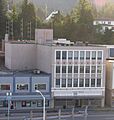
Ketchikan City Hall, Alaska
-
Seal of Ketchikan Gateway Borough
-

Ketchikan Gateway Borough logo
See also
 In Spanish: Borough de Ketchikan Gateway para niños
