Wartburgkreis Rural District facts for kids
Quick facts for kids
Wartburgkreis
|
|
|---|---|
 |
|
| Country | |
| State | Thuringia |
| Capital | Bad Salzungen |
| Area | |
| • Total | 1,305 km2 (504 sq mi) |
| Population
(2002)
|
|
| • Total | 142,595 |
| • Density | 109.27/km2 (283.00/sq mi) |
| Time zone | UTC+1 (CET) |
| • Summer (DST) | UTC+2 (CEST) |
| Vehicle registration | WAK |
| Website | http://www.wartburgkreis.de |
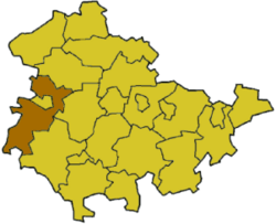
The Wartburgkreis is a Landkreis, which means a rural district, in the western part of Thuringia, Germany. The city of Eisenach is almost completely surrounded by the Wartburgkreis.
History of the District
This district was created in 1994. It was formed by joining two older districts: Eisenach and Bad Salzungen. A few towns from the Bad Langensalza district also joined. In 1998, the city of Eisenach left the district. It became a "district-free city," meaning it manages itself and is not part of the surrounding rural district.
The Wartburgkreis gets its name from the famous Wartburg Castle. This castle is near Eisenach. It is well-known because Martin Luther found refuge there in 1521. He stayed there to hide and translate the New Testament into German.
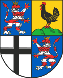
What the Coat of Arms Means
Towns and Communities
This district includes many towns and communities. Some of them manage themselves, while others are part of a group called a Verwaltungsgemeinschaft. This is like a shared administration for smaller towns.
Towns and communities that manage themselves:
| Verwaltungsgemeinschaft-free towns | and municipalities | |
|---|---|---|
|
|
|
Groups of communities (Verwaltungsgemeinschaften):
| Verwaltungsgemeinschaften | ||
|---|---|---|
|
|
|
| 1seat of the Verwaltungsgemeinschaft; 2town | ||
See also
 In Spanish: Wartburgkreis para niños
 | Lonnie Johnson |
 | Granville Woods |
 | Lewis Howard Latimer |
 | James West |


