Wathena, Kansas facts for kids
Quick facts for kids
Wathena, Kansas
|
|
|---|---|

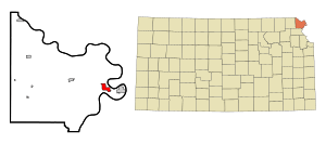
Location within Doniphan County and Kansas
|
|

|
|
| Country | United States |
| State | Kansas |
| County | Doniphan |
| Founded | 1861 |
| Incorporated | 1873 |
| Named for | Chief Wathena |
| Area | |
| • Total | 2.38 sq mi (6.17 km2) |
| • Land | 2.34 sq mi (6.07 km2) |
| • Water | 0.04 sq mi (0.11 km2) |
| Elevation | 814 ft (248 m) |
| Population
(2020)
|
|
| • Total | 1,246 |
| • Density | 523.5/sq mi (201.94/km2) |
| Time zone | UTC-6 (CST) |
| • Summer (DST) | UTC-5 (CDT) |
| ZIP code |
66090
|
| Area code | 785 |
| FIPS code | 20-76000 |
| GNIS ID | 2397215 |
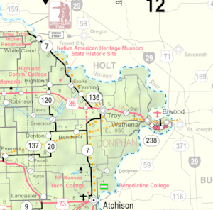
Wathena is a city in Doniphan County, Kansas, United States. It is located about 5 miles (8 km) west of St. Joseph, Missouri. In 2020, the city had a population of 1,246 people.
Contents
History of Wathena
Wathena was founded in 1856. The city is named after Chief Wathena. He was a Native American chief of the Kickapoo tribe. His tribe lived in this area before the city was founded.
The first post office in Wathena opened in 1855. For a few years, it was called Bryan. In 1859, its name changed to Wathena.
A railroad, the St. Joseph & Denver Railroad, reached Wathena in 1860. This helped the city grow. Wathena officially became a city in 1873.
Geography and Location
Wathena is located in the northeastern part of Kansas. The United States Census Bureau says the city covers about 2.31 square miles (5.98 square kilometers). Most of this area is land. Only a small part, about 0.03 square miles (0.08 square kilometers), is water.
People of Wathena
Wathena is part of the St. Joseph, MO–KS Metropolitan Statistical Area. This means it is part of a larger group of cities and towns around St. Joseph.
Population in 2010
In 2010, there were 1,364 people living in Wathena. These people lived in 550 households. About 365 of these households were families.
The city had about 598 people per square mile (231 people per square kilometer). Most residents, about 96.6%, were White.
About 32.4% of households had children under 18 years old. Many households, 50%, were married couples. The average household had 2.40 people. The average family had 2.92 people.
The average age of people in Wathena was 40.9 years. About 24.7% of residents were under 18. About 17.8% were 65 or older. There were slightly more females (52.8%) than males (47.2%) in the city.
Education in Wathena
The Riverside USD 114 public school district serves the community. In 2010, the schools in Elwood and Wathena joined together. This formed the USD 114 district. The high school team is called the Riverside Cyclones.
Before this, Wathena had its own high school. Its mascot was the Wathena Wildcats. That high school is now closed due to the school unification.
Well-Known People from Wathena
- Louis W. Staudenmaier was born in Wathena. He later became a state legislator and lawyer in Wisconsin.
See also
 In Spanish: Wathena (Kansas) para niños

