Watonga Lake facts for kids
Quick facts for kids Watonga Lake |
|
|---|---|
| Location | Blaine County, Oklahoma |
| Coordinates | 35°56′33″N 98°25′23″W / 35.9423635°N 98.4230317°W |
| Type | Reservoir |
| Native name | Watonga Lake Error {{native name checker}}: parameter value is malformed (help) |
| Built | 1955 |
| Max. depth | 26 feet (7.9 m) |
| Water volume | 656 acre-feet (809,000 m3) |
| Shore length1 | 2.5 miles (4.0 km) |
| Surface elevation | 1,375 feet (419 m) |
| Settlements | Watonga, Oklahoma |
| 1 Shore length is not a well-defined measure. | |
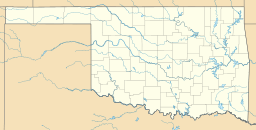
Watonga Lake is a special kind of lake called a reservoir. It's located in Blaine County, Oklahoma. This lake is about 7 miles (11 km) north of the town of Watonga, Oklahoma. It was built in 1955 by the Oklahoma Department of Wildlife Conservation (ODWC). Watonga Lake is right next to Roman Nose State Park, and they share many fun activities for visitors.
How Watonga Lake Got Its Name
The name "Watonga" comes from an important leader of the Arapaho tribe. His name was also spelled woteen-kotuh'oo. It means "black coyote."
About Watonga Lake
Watonga Lake is smaller than many other lakes in Oklahoma. Its surface area is about 55 acres (22 ha). That's like having 55 football fields of water!
The lake holds about 656 acre-feet (809,000 m3) of water. Its shoreline, which is the edge all around the lake, is about 2.5 miles (4.0 km) long. The average depth of the lake is about 11.9 feet (3.6 m). At its deepest point, Watonga Lake goes down 26 feet (7.9 m). The lake sits at an elevation of 1,375 feet (419 m) above sea level.


