Watsontown, Pennsylvania facts for kids
Quick facts for kids
Watsontown, Pennsylvania
|
|
|---|---|
|
Borough
|
|
|
Watsontown Borough Building
|
|

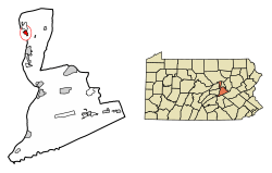
Location of Watsontown in Northumberland County, Pennsylvania.
|
|
| Country | United States |
| State | Pennsylvania |
| County | Northumberland |
| Settled | 1794 |
| Incorporated (borough) | 1858 |
| Area | |
| • Total | 0.93 sq mi (2.42 km2) |
| • Land | 0.71 sq mi (1.84 km2) |
| • Water | 0.22 sq mi (0.58 km2) |
| Elevation
(benchmark at center of borough)
|
484 ft (148 m) |
| Highest elevation
(eastern end of borough by cemetery)
|
590 ft (180 m) |
| Lowest elevation
(West Branch Susquehanna River)
|
450 ft (140 m) |
| Population
(2020)
|
|
| • Total | 2,237 |
| • Density | 3,155.15/sq mi (1,217.65/km2) |
| Time zone | Eastern (EST) |
| • Summer (DST) | EDT |
| ZIP code |
17777
|
| Area code(s) | 570 and 272 |
| FIPS code | 42-81616 |
Watsontown is a small town, called a borough, located in Northumberland County, Pennsylvania, United States. It was named after John Watson, who was an early settler in the area. In 2020, about 2,237 people lived there.
Contents
History of Watsontown
Early Settlement and Growth
The land where Watsontown now stands was first bought by John Watson in 1792. The town's post office opened in 1828, helping people send and receive mail. For a short time, from 1830 to 1840, Watsontown even had a racetrack!
Railroad tracks first reached the borough in 1854, making it easier to travel and transport goods. A sawmill, which cuts wood, was built in 1856. Watsontown was originally part of Turbot Township until it officially became its own borough in 1867.
Watsontown's Role in Transportation
Watsontown was a very important part of a big transportation network. This network included roads, railroads, and canals along the Susquehanna River. Because of its location, many businesses chose to set up shop here.
Watsontown also played a special role in the Underground Railroad. This was a secret network that helped enslaved people escape to freedom in Canada. Part of the old canal and the path used by mules to pull boats can still be seen along the river today.
Geography of Watsontown
Watsontown covers a total area of about 0.9 square miles (2.4 square kilometers). Most of this area, about 0.7 square miles (1.8 square kilometers), is land. The rest, about 0.2 square miles (0.5 square kilometers), is water.
The land in Watsontown is mostly flat. There is one small hill located in the eastern part of the borough. Most of the land is used for homes, but there are also some forests and areas for businesses and factories. The West Branch Susquehanna River runs along the western side of Watsontown. You can reach the borough by using Pennsylvania Route 44 and Pennsylvania Route 405.
Population of Watsontown
| Historical population | |||
|---|---|---|---|
| Census | Pop. | %± | |
| 1870 | 1,181 | — | |
| 1880 | 1,481 | 25.4% | |
| 1890 | 2,157 | 45.6% | |
| 1900 | 1,898 | −12.0% | |
| 1910 | 1,950 | 2.7% | |
| 1920 | 2,153 | 10.4% | |
| 1930 | 2,248 | 4.4% | |
| 1940 | 2,282 | 1.5% | |
| 1950 | 2,327 | 2.0% | |
| 1960 | 2,431 | 4.5% | |
| 1970 | 2,514 | 3.4% | |
| 1980 | 2,366 | −5.9% | |
| 1990 | 2,310 | −2.4% | |
| 2000 | 2,255 | −2.4% | |
| 2010 | 2,351 | 4.3% | |
| 2020 | 2,237 | −4.8% | |
| Sources: | |||
In the year 2000, there were 2,254 people living in Watsontown. These people lived in 967 households. A household is a group of people living together in one home.
About 25% of the households had children under 18 years old living with them. The average household had about 2.21 people. The population was spread out in terms of age. About 21% of the people were under 18 years old. About 21% were 65 years or older. The average age of people in Watsontown was 41 years old.
Arts and Culture in Watsontown
The Watsontown River Bridge is a special landmark. It is listed on the National Register of Historic Places. This means it is an important historical site.
Watsontown also had a movie theater called the Watsontown Theater. It was open for many years, from 1940 until 2009.
See also
 In Spanish: Watsontown para niños


