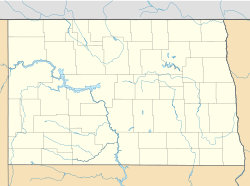
West Adams, North Dakota facts for kids
Quick facts for kids
West Adams, North Dakota
|
|
|---|---|
|
Unorganized territory
|
|
| Country | United States |
| State | North Dakota |
| County | Adams |
| Area | |
| • Total | 67.0 sq mi (173.4 km2) |
| • Land | 66.9 sq mi (173.2 km2) |
| • Water | 0.08 sq mi (0.2 km2) |
| Elevation | 2,831 ft (863 m) |
| Population
(2010)
|
|
| • Total | 34 |
| • Density | 0.5/sq mi (0.2/km2) |
| Time zone | UTC-6 (Central (CST)) |
| • Summer (DST) | UTC-5 (CDT) |
| Area code(s) | 701 |
| GNIS feature ID | 1036002 |
West Adams is a special kind of area in Adams County, North Dakota, United States. It's called an "unorganized territory." This means it doesn't have its own local government like a city or a regular township. Instead, the county government handles most things for the people living there.
In 2010, only 34 people lived in West Adams. It covers the land that used to be two separate areas called Lemmon Township and Whetstone Township.
Contents
What is an Unorganized Territory?
An unorganized territory is a part of a county that doesn't have its own local government. This is different from a city or a town, which usually have a mayor and a city council. In an unorganized territory, the county government takes care of services like roads, law enforcement, and other public needs. This setup is common in parts of the United States where there are very few people living.
Why are some areas unorganized?
Areas often become unorganized because they have a very small population. It wouldn't make sense to set up a full local government for just a few people. By letting the county handle things, it saves money and makes administration simpler.
Where is West Adams Located?
West Adams is found in the southwestern part of North Dakota. North Dakota is a state in the northern central part of the United States. It is known for its wide-open spaces and farming.
Adams County
West Adams is part of Adams County. This county is located in the southwest corner of North Dakota. The county seat, which is the main town where the county government is located, is Hettinger.
Geography and Climate
West Adams covers about 173.4 square kilometers (about 67 square miles). Most of this area is land, with a very small amount of water. The land here is generally flat or gently rolling, typical of the Great Plains region. The weather in this part of North Dakota can be very cold in winter and warm in summer.
Population Details
As of the 2010 census, West Adams had a population of 34 people. This makes it a very sparsely populated area. The population density was about 0.2 people per square kilometer, meaning there are very few people living in a large space.
What is a Census?
A census is an official count of the population in a country or region. In the United States, a census is done every ten years. It helps the government understand how many people live in different areas and how populations are changing. This information is used for many things, like planning public services and deciding how many representatives each state gets in Congress.
See also
 In Spanish: West Adams (Dakota del Norte) para niños
 | Emma Amos |
 | Edward Mitchell Bannister |
 | Larry D. Alexander |
 | Ernie Barnes |


