Westport, Indiana facts for kids
Quick facts for kids
Westport, Indiana
|
|
|---|---|

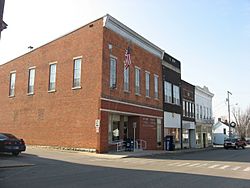
Main Street
|
|

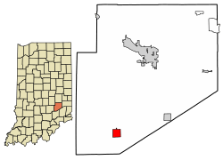
Location of Westport in Decatur County, Indiana.
|
|
| Country | United States |
| State | Indiana |
| County | Decatur |
| Township | Sand Creek |
| Area | |
| • Total | 1.16 sq mi (3.01 km2) |
| • Land | 1.15 sq mi (2.98 km2) |
| • Water | 0.01 sq mi (0.03 km2) |
| Elevation | 801 ft (244 m) |
| Population
(2020)
|
|
| • Total | 1,393 |
| • Density | 1,211.30/sq mi (467.55/km2) |
| Time zone | UTC-5 (EST) |
| • Summer (DST) | UTC-5 (EST) |
| ZIP code |
47283
|
| Area code(s) | 812 |
| FIPS code | 18-83276 |
| GNIS feature ID | 2397736 |
| Website | http://www.westportindiana.org |
Westport is a small town in Decatur County, Indiana. It is part of Sand Creek Township. In 2010, about 1,379 people lived there. A special covered bridge, built in 1880, can be found just east of the town.
Contents
History of Westport
Westport was first planned in March 1836. Simeon Sharp and Hockersmith Merryman were the founders. They created 20 building lots around the middle point where Main and Poplar Streets meet. The town's post office opened in 1839. It was first spelled "West Port."
Geography and Location
Westport covers about 1.33 square miles (3.45 square kilometers). Most of this area is land, about 1.32 square miles (3.42 square kilometers). A very small part, about 0.013 square miles (0.034 square kilometers), is water.
Population and People
| Historical population | |||
|---|---|---|---|
| Census | Pop. | %± | |
| 1880 | 212 | — | |
| 1890 | 452 | 113.2% | |
| 1900 | 614 | 35.8% | |
| 1910 | 675 | 9.9% | |
| 1920 | 709 | 5.0% | |
| 1930 | 637 | −10.2% | |
| 1940 | 644 | 1.1% | |
| 1950 | 658 | 2.2% | |
| 1960 | 833 | 26.6% | |
| 1970 | 1,170 | 40.5% | |
| 1980 | 1,450 | 23.9% | |
| 1990 | 1,478 | 1.9% | |
| 2000 | 1,515 | 2.5% | |
| 2010 | 1,379 | −9.0% | |
| 2020 | 1,393 | 1.0% | |
| U.S. Decennial Census | |||
Westport's 2010 Census Data
In 2010, there were 1,379 people living in Westport. These people lived in 548 households, and 369 of these were families. The town had about 1,045 people per square mile. There were 653 homes in total.
Most of the people in Westport were White (98.5%). A small number were African American (0.1%), Native American (0.2%), or Asian (0.1%). About 1.1% of the people were from two or more racial backgrounds. About 0.9% of the population was Hispanic or Latino.
Households and Families
Out of the 548 households:
- 34.7% had children under 18 living there.
- 48.0% were married couples living together.
- 14.8% had a female head of the house with no husband.
- 4.6% had a male head of the house with no wife.
- 32.7% were not families.
About 27.7% of all households had only one person living there. About 11.1% of households had someone aged 65 or older living alone. On average, each household had 2.52 people, and each family had 3.08 people.
Age of Residents
The average age in Westport was 36.4 years old.
- 27.6% of residents were under 18 years old.
- 8.3% were between 18 and 24 years old.
- 26.1% were between 25 and 44 years old.
- 23.8% were between 45 and 64 years old.
- 14.1% were 65 years old or older.
The town had slightly more females (51.5%) than males (48.5%).
Education in Westport
Students in Westport attend schools that are part of the Decatur County Community Schools system.
See also
 In Spanish: Westport (Indiana) para niños
 | William Lucy |
 | Charles Hayes |
 | Cleveland Robinson |


