Westwood Highlands, San Francisco facts for kids
Quick facts for kids
Westwood Highlands
|
|
|---|---|

Panoramic view of the neighborhood in 2010
|
|
| Area | |
| • Total | 0.46 km2 (0.178 sq mi) |
| Population
(2008)
|
|
| • Total | 1,782 |
| • Density | 3,856/km2 (9,986/sq mi) |
| ZIP Code |
94127
|
| Area codes | 415/628 |
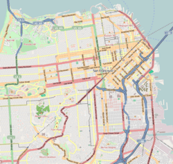
Westwood Highlands is a small neighborhood in San Francisco, California. It's located in the south-central part of the city. It's surrounded by other neighborhoods like Westwood Park and Saint Francis Wood. Nearby is Mount Davidson, the highest point in San Francisco.
This neighborhood covers about 0.178 square miles. In 2009, about 1,782 people lived there. Families in Westwood Highlands generally earn more than the average for San Francisco.
Westwood Highlands is a planned community of 283 homes. These homes were built between 1925 and 1929. It was one of the first communities in the United States to have special rules. These rules were called covenants and restrictions.
Contents
A Look Back: How Westwood Highlands Began
In 1906, a huge earthquake hit San Francisco. Fires followed, causing even more damage. This disaster led to a big rebuilding effort. Areas that were once farmland, like near Twin Peaks, became places for homes.
The Twin Peaks Tunnel and City Growth
In 1918, the Twin Peaks Tunnel opened. This tunnel made it easier to build new suburbs. The Muni Metro train system ran through it. This connected downtown San Francisco to areas like West Portal.
The tunnel cut travel time to downtown from almost an hour to just twenty minutes. This made it possible for people to live in a "commuter suburb". They could easily travel to work in the city.
Building a Community: Baldwin and Howell
The real estate company for Westwood Highlands was Baldwin and Howell. They were known for designing communities well. They worked with a builder named Hans Nelson and an architect named Charles Strothoff.
They planned Westwood Highlands as a commuter suburb. Their goal was to create "efficient and economical design" for middle-class families. Unlike other neighborhoods, homes here followed specific designs. This made the whole area look unified and connected.
Designing Homes and Streets
When planning Westwood Highlands, designers thought carefully about how houses would look from the street. Architect Charles Strothoff used a modular system for the homes. This meant parts of the house could be changed or swapped.
Modular Home Design
The modular system allowed for different house layouts. Strothoff used three main parts: the window, the entrance, and the garage. Most homes used three of these parts. This created variety while keeping a similar look.
This system made sure that homes looked different enough. But they still fit the overall style of the neighborhood. It helped control the look of the streets.
Curvy Streets and Corner Lots
Most of San Francisco uses a grid system for its streets. But Westwood Highlands used curvy streets. This design worked well with the hilly land.
Corner lots were special. They helped connect the public streets with private homes. These lots were designed to face the street intersection at an angle. This made the neighborhood feel more open and friendly.
How Land Value Was Decided
In earlier developments, people bought empty lots and built whatever they wanted. But in Westwood Highlands, you bought a complete package. This included the land and a pre-designed house.
The hills and slopes influenced the value of each lot. Homes on steeper hills often had smaller lots. They also had smaller houses, but they came with city views. Larger lots had more affordable houses. These were usually on the outer, eastern edges of the development.
Lasting Influence on City Planning
Westwood Highlands was built partly because of the 1906 earthquake. But it also responded to the growing population. This private development had a big impact on city planning.
Promoting a Lifestyle
Baldwin and Howell didn't just sell houses. They promoted a lifestyle. They emphasized that living in Westwood Highlands was community-focused, affordable, and comfortable. They especially targeted middle-class families.
Rules for Development
The Real Estate Associates, a big developer from the late 1800s, set rules for housing developments. Some of these rules were used in Westwood Highlands. These included ideas about wealth and how areas were organized.
The rules about house design were like today's planning restrictions. These rules helped control how the community looked and functioned in the 1920s. Real estate agents back then didn't just sell homes. They also helped shape communities and social order.
Westwood Highlands is a great example of private planning in America. By promoting the suburban lifestyle, Baldwin and Howell created important planning practices. These ideas still influence how communities are planned today.


