Mount Davidson (California) facts for kids
Quick facts for kids Mount Davidson |
|
|---|---|
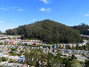
Mount Davidson as seen from Forest Hill Extension
|
|
| Highest point | |
| Elevation | 928 ft (283 m) NAVD 88 |
| Prominence | 627 ft (191 m) |
| Listing | |
| Geography | |
| Location | San Francisco, California U.S., United States |
| Topo map | USGS San Francisco South |
| Climbing | |
| Easiest route | Hike |
| Mount Davidson Park | |
|---|---|
| Type | Municipal (San Francisco) |
| Location | San Francisco |
| Area | 38 acres (15 ha) |
| Created | 1920s |
| Status | Open all year |
Mount Davidson is the tallest natural point in San Francisco, California. It stands 928 feet (283 m) high. This makes it a very important landmark in the city.
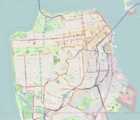
Mount Davidson is located on the west side of San Francisco. It is south of Twin Peaks. It is also west of Diamond Heights and Glen Park. You can often see it from Portola Drive. It is one of San Francisco's original "Seven Hills."
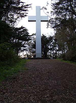
The most famous part of Mount Davidson is its huge concrete cross. This cross is 103-foot (31.4 m) tall. It sits right at the top of the hill. Every year, a special prayer service happens here on Easter. The cross is lit up for this event. There is also a yearly event on April 24 to remember the Armenian genocide.
Mount Davidson Park covers most of the hill. The very top part where the cross stands is privately owned. The park is a great place for outdoor activities. It is located between Myra Way, Dalewood Way, and Juanita Way. You can get there by taking the 36 Teresita Muni bus. It stops right at the park entrance.
The neighborhoods around Mount Davidson Park include Miraloma Park to the east. To the southwest are Westwood Highlands and Sherwood Forest.
Contents
Mount Davidson's History
Early Days and Naming
In April 1865, people in San Francisco heard big news. Robert E. Lee had surrendered at Appomattox. A patriotic citizen named Matilda Heron sent someone to the top of the hill. They raised the American flag there.
Later, in 1881, Adolph Sutro bought the land. After he passed away, the highest of the San Miguel hills was named "Mount Davidson." This was done to honor George Davidson. He was a founding member of the Sierra Club.
Developing the Area
In 1911, A.S. Baldwin bought the western side of the mountain. He also bought land to the north and south. Baldwin then made plans to build several neighborhoods. These included St. Francis Wood, Westwood Park, and Sherwood Forest.
The Famous Cross
Building the Crosses
The first cross on Mount Davidson was temporary. It was 40 feet (12 m) tall and put up in 1923. A service was held there by Dean J. Wilmer Gresham. A second, taller cross was built in 1924. It was 87-foot (27 m) high but burned down in 1925.
In 1926, another cross, almost 100 feet (30 m) tall, was built. It was lit up for a week before Easter. This one also burned down in 1928. In 1929, an 80-foot (24 m) high cross made of wood and stucco was built. It had lights.
That same year, the city of San Francisco bought 20 acres (8.1 ha) at the top of Mount Davidson. This land became a park. Funds for this were donated by the Mount Davidson Conservation Committee. Mrs. A. S. Baldwin also gave 6 acres (2.4 ha) more land to the city. Sadly, arsonists burned down the 1929 cross in 1931.
The Permanent Cross
In 1933, leaders like Mayor Angelo Rossi and Governor James Rolph wanted a permanent cross. They wanted to honor early California pioneers. The current 103-foot (31 m) high concrete and steel cross was finished in 1934.
President Franklin D. Roosevelt helped light the cross. He did this by telegraph from the White House on March 24, 1934. This was just eight days before Easter. Easter sunrise services have been held at the cross ever since. These services were even broadcast across the country for many years.
The Cross in Movies
The cross has appeared in movies. Director Don Siegel filmed a scene from the 1971 movie Dirty Harry there. The main character, Harry, confronts someone at the base of the cross. Filming was tricky because of the cross's height and foggy weather.
In 1973, the cross site was used again. It appeared in an episode of The Streets of San Francisco. This scene was similar to the one in Dirty Harry.
Discussions About the Cross
Over the years, there have been many discussions about the cross. People talked about its religious meaning and its role as a historic landmark. In 1997, the City of San Francisco sold the land where the cross stands. This land was bought by The Council of Armenian American Organizations of Northern California.
This group placed a bronze plaque at the base of the cross. It remembers the victims of the 1915 Armenian genocide. In 2007, the 160-pound (73 kg) plaque went missing. A new plaque was put in its place in April 2008.
See also
 | Shirley Ann Jackson |
 | Garett Morgan |
 | J. Ernest Wilkins Jr. |
 | Elijah McCoy |


