Whangamatā facts for kids
Quick facts for kids
Whangamatā
|
|
|---|---|

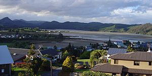
A view of Whangamatā
|
|
| Country | New Zealand |
| Region | Waikato |
| District | Thames-Coromandel District |
| Ward | South Eastern ward |
| Community Board | Whangamatā Community |
| Electorates |
|
| Area | |
| • Total | 8.46 km2 (3.27 sq mi) |
| Population
(June 2023)
|
|
| • Total | 4,500 |
| • Density | 532/km2 (1,378/sq mi) |
| Postcode(s) |
3620
|
Whangamatā is a lively town on the southeast coast of the Coromandel Peninsula in the North Island of New Zealand. It is about 30 kilometres north of Waihi. This town is a popular spot, especially during holidays.
During holiday times, like New Year's, the number of people in Whangamatā grows a lot. The town can fill up with over 25,000 visitors! This makes it a very busy and fun place to be.
Contents
What's in a Name?
The name 'Whangamatā' comes from the Māori words 'whanga' and 'matā'. 'Whanga' means bay, and 'matā' means a hard stone. This name refers to a type of stone called obsidian that washes up on the beach. Long ago, people used these stones to make tools.
Beaches and Islands
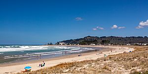
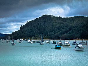
Whangamatā has two main ocean beaches. Both are known for being very safe for swimming and surfing. There is also a safe harbour for boats at the north end of town. Another river mouth (estuary) is at the south end.
You can see several islands from the beach.
- Hauturu or Clark Island is an island you can walk to when the tide is low. It is a favourite spot in summer for finding cool things in rock pools and for kayaking.
- Whenuakura, also called Donut Island, is about one kilometre east of the southern part of Whangamatā beach. This island has a large hole that has fallen in, creating a small beach inside the island. This is why it is called Donut Island! Until recently, Tuatara (a type of reptile) lived on Whenuakura.
Other beautiful beaches are close by. Whiritoa is a quiet beach about 15 minutes south of Whangamatā. To the north, you can find Onemana and Opoutere beaches.
People of Whangamatā
Whangamatā is home to about 4,074 people, based on the 2018 New Zealand census. This number has grown quite a bit over the years. The people living here are from many different backgrounds. Most are European/Pākehā, but there are also many Māori, Pacific peoples, and Asian people. This mix of cultures makes Whangamatā a diverse community.
Whangamatā Marina
A marina was built in the Whangamatā estuary. An estuary is where a river meets the sea. This one is quite shallow. Building the marina caused some debate. Many people, including surfers and environmental groups, were worried about how it would affect the natural area. They were also concerned about a special surf spot nearby.
The marina project went ahead after a court hearing set rules for its construction. It was important to make sure the building work did not harm the environment too much. Sadly, some rare animals, like the Oligosoma moco skink, were affected by the development. The marina officially opened in November 2009.
After the marina opened, some surfers and scientists noticed that the famous surf break, called the Whangamatā Bar, seemed to get worse for surfing. People are still trying to figure out if the marina caused this change or if it was natural. Protecting this surf spot is important under New Zealand's coastal rules.
Education
Whangamatā has a school called Whangamatā Area School. It teaches students from their first year of school all the way up to year 13 (the last year of high school).
Climate
| Climate data for Whangamata (Tairua Forest) (1981–2010) | |||||||||||||
|---|---|---|---|---|---|---|---|---|---|---|---|---|---|
| Month | Jan | Feb | Mar | Apr | May | Jun | Jul | Aug | Sep | Oct | Nov | Dec | Year |
| Mean daily maximum °C (°F) | 23.8 (74.8) |
24.0 (75.2) |
22.4 (72.3) |
20.0 (68.0) |
17.3 (63.1) |
15.4 (59.7) |
14.6 (58.3) |
15.2 (59.4) |
16.9 (62.4) |
18.2 (64.8) |
20.2 (68.4) |
22.4 (72.3) |
19.2 (66.6) |
| Daily mean °C (°F) | 19.0 (66.2) |
19.4 (66.9) |
17.6 (63.7) |
15.3 (59.5) |
12.9 (55.2) |
10.7 (51.3) |
9.9 (49.8) |
10.5 (50.9) |
12.4 (54.3) |
13.7 (56.7) |
15.8 (60.4) |
17.7 (63.9) |
14.6 (58.2) |
| Mean daily minimum °C (°F) | 14.3 (57.7) |
14.9 (58.8) |
12.9 (55.2) |
10.5 (50.9) |
8.5 (47.3) |
6.0 (42.8) |
5.2 (41.4) |
5.8 (42.4) |
7.9 (46.2) |
9.3 (48.7) |
11.3 (52.3) |
13.1 (55.6) |
10.0 (49.9) |
| Average rainfall mm (inches) | 116.8 (4.60) |
128.8 (5.07) |
174.1 (6.85) |
141.4 (5.57) |
108.7 (4.28) |
179.3 (7.06) |
128.2 (5.05) |
189.3 (7.45) |
116.4 (4.58) |
107.3 (4.22) |
123.2 (4.85) |
108.6 (4.28) |
1,622.1 (63.86) |
| Source: NIWA | |||||||||||||
 | Ernest Everett Just |
 | Mary Jackson |
 | Emmett Chappelle |
 | Marie Maynard Daly |


