Coromandel Peninsula facts for kids
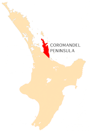
The Coromandel Peninsula is a long piece of land in New Zealand. It stretches about 85 kilometers (53 miles) north from the Bay of Plenty on the North Island. This peninsula acts like a natural wall. It protects the Hauraki Gulf and the Firth of Thames from the Pacific Ocean.
At its widest point, the Coromandel Peninsula is about 40 kilometers (25 miles) across. Most people live along the narrow coastal areas. If the weather is clear, you can easily see the peninsula from Auckland. Auckland is New Zealand's biggest city, located about 55 kilometers (34 miles) to the west. The Coromandel Peninsula is part of the Thames-Coromandel District in the Waikato region.
Contents
Why is it Called Coromandel?
The Coromandel Peninsula got its name from a British Royal Navy ship. This ship was called HMS Coromandel. In 1820, the ship visited Coromandel Harbour to buy kauri wood. The ship itself was named after the Coromandel Coast in India.
Exploring the Geography
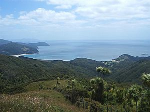
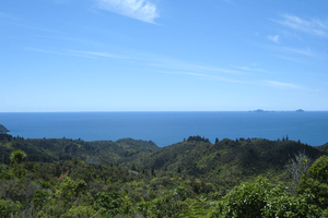
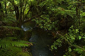
The peninsula is very hilly and covered in thick native forest, often called "bush." The Coromandel Range forms the main backbone of the peninsula. At the northern end, the Moehau Range has the highest point, which is almost 900 meters (2,950 feet) tall. Great Barrier Island is a large island beyond the northern tip. It can be thought of as an extension of these mountain ranges.
Even though the peninsula is close to big cities like Auckland and Tauranga, much of it feels isolated. This is because the land is very rugged. The inner parts and the northern tip are mostly undeveloped. Not many people live there. The Coromandel Forest Park covers a large part of the peninsula's interior.
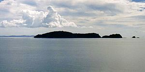
Many small islands are found just off the coast. These include the Motukawao Islands to the northwest. The Aldermen Islands and Slipper Island are to the southeast. The Mercury Islands are located to the northeast.
The Coromandel Peninsula shows many signs of past volcanoes. It is made up of old volcanoes that were very active a long time ago. Today, volcanic activity has moved southeast. However, you can still find hot springs on the peninsula. A famous spot is Hot Water Beach, where you can dig in the sand and find warm water bubbling up!
Who Lives on the Coromandel?
Because of the hilly land, most people on the Coromandel live in towns along the southeastern and southwestern coasts. Only five towns have more than 1,000 people. These are Coromandel, Whitianga, Thames, Tairua, and Whangamatā. Of these, only Thames (with about 7,400 people) and Whitianga (with about 6,200 people) have populations over 5,000.
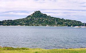
Many small towns are found along the coast of the Firth of Thames. Other small towns include Te Puru, Matarangi, Whangapoua, Whiritoa, Hikuai, Port Jackson, Port Charles, Pauanui and Colville.
The number of people in these towns changes a lot with the seasons. Many people from Auckland have holiday homes here. During the summer holidays, especially around Christmas and New Year, many families visit. This makes the area very busy, especially in Whangamatā, Whitianga, Matarangi, Tairua, and Pauanui.
The peninsula is also a popular place for people seeking a different way of life. In the 1970s, many people moved from cities to the Coromandel. They wanted to live closer to nature. More recently, people from Auckland have also started moving to the Coromandel.
Fewer people live further away from the coast. Also, fewer people live in the northern parts of the peninsula. Most of the inner areas are almost empty.
A Look at History
Before Europeans arrived, the Tahanga Quarries at Ōpito Bay were very important. Māori people used the basalt rock from these quarries. They used it to make stone tools like adzes. This was especially true during the early Māori period (between 1300 and 1500).
What to Do and See
The Coromandel Peninsula was once known for its gold mining and kauri tree logging. Today, it is a very popular place for tourists. Most mining stopped around the 1980s.
A large forest park covers the middle of the peninsula. The coasts are full of beautiful beaches and amazing views. You can still see signs of the area's volcanic past at hot springs. The most famous is Hot Water Beach on the east coast.
The town of Whangamatā is a popular holiday spot. Whitianga, on Mercury Bay, is famous for yachting. The waters around the peninsula are also great for scuba diving. Cathedral Cove is a well-known place. It has a huge archway through a limestone cliff that looks like a cathedral. You can only reach it by boat or by walking.
In recent years, dolphins and some types of whales have been seen more often along the coasts. Their numbers are starting to grow again. You might spot southern right whales, Bryde's whales, or humpback whales.
Getting Around
The towns on the peninsula are connected by State Highways 25 and 25A. These highways form a loop around the peninsula. Not all roads inside the peninsula are paved. For example, the 309 Road connects Coromandel Town and Whitianga. This road is a gravel road. Some car rental companies do not allow driving on these unpaved roads.
A passenger ferry runs from Ferry Landing to Whitianga. This ferry is great for people walking or cycling. It gives them direct access to the shops and restaurants in Whitianga. The ferry trip across the harbor only takes 5 minutes. Driving by road would take 40 to 45 minutes!
See also
 In Spanish: Península de Coromandel para niños
 | Emma Amos |
 | Edward Mitchell Bannister |
 | Larry D. Alexander |
 | Ernie Barnes |


