Great Barrier Island facts for kids
|
Aotea (Māori)
Nickname: The Barrier
|
|
|---|---|
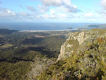
Kaitoke Beach in the east of Great Barrier Island. The "White Cliffs" can be seen in the front right.
|
|
| Geography | |
| Location | North Island |
| Coordinates | 36°12′S 175°25′E / 36.200°S 175.417°E |
| Area | 285 km2 (110 sq mi) |
| Highest elevation | 621 m (2,037 ft) |
| Highest point | Mount Hobson or Hirakimatā |
| Administration | |
|
New Zealand
|
|
| Demographics | |
| Population | 930 (2018) |
| Pop. density | 3 /km2 (8 /sq mi) |
Great Barrier Island (which is called Aotea in the Māori language) is an island in New Zealand. It's about 100 kilometers (62 miles) north-east of Auckland. It's the sixth largest island in New Zealand, covering an area of 285 square kilometers (110 square miles).
The highest point on the island is Mount Hobson, also known as Hirakimatā, which is 627 meters (2,057 feet) high. The island is looked after by the Auckland Council.
Long ago, people came to the island for its minerals and kauri trees. Today, about 930 people live there, mostly working in farming and tourism. Almost everyone on the island lives "off-the-grid," meaning they make their own electricity.
A big part of the island (about 60%) is a nature reserve, managed by the Department of Conservation. Life on Great Barrier Island is often described as being like New Zealand many decades ago.
Contents
What's in a Name?
The Māori name for the island is Aotea. The English name, Great Barrier Island, was given by Captain Cook. He called it that because it acts like a big wall, or "barrier," between the Pacific Ocean and the Hauraki Gulf.
The island protects the Hauraki Gulf from big ocean waves and strong currents. There are two main channels, or waterways, that let boats into the Hauraki Gulf, one on each side of the island.
Island Geography
Great Barrier Island is the sixth largest island in New Zealand. Only the South Island, North Island, Stewart Island/Rakiura, Chatham Island, and Auckland Island are bigger. As mentioned, its highest point is Mount Hobson (or Hirakimatā), which is 627 meters (2,057 feet) above sea level.
Several smaller islands surround Great Barrier Island. These include Kaikoura Island, Rakitu Island, Aiguilles Island, and Dragon Island. Many other small islands are found within the bays of Great Barrier Island itself.
The island is about 43 kilometers (27 miles) long from north to south. Along with the Coromandel Peninsula to its south, it protects the Hauraki Gulf from storms coming from the Pacific Ocean. This means the island has two very different coastlines.
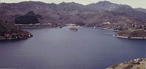
The eastern coast has long, sandy beaches, windy sand-dunes, and often big waves. The western coast, however, is calm and sheltered. It has many small, hidden bays that are great for diving and boating. Inland, you'll find large wetlands, rugged hills, and forests with old kauri trees and new growth.
History and Culture
Great Barrier Island, or Aotea, is the traditional home of the Ngāti Rehua Ngātiwai ki Aotea people. They are the original people of the land and have lived on Aotea since the 1600s.
Local Industries
Mining History
Europeans first became interested in the island when copper was found in the north. New Zealand's earliest mines were set up there in 1842. You can still see traces of these old mines today, though they are mostly reached by boat.
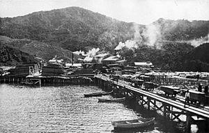
Later, in the 1890s, gold and silver were discovered in the Okupu and Whangaparapara areas. The remains of a stamping battery, a machine used to crush rock for minerals, can still be seen on Whangaparapara Road. It's said that the sound of this machine working could be heard 20 kilometers (12 miles) away on the Coromandel Peninsula!
Kauri Logging
Logging kauri trees was a very profitable business for early European settlers, lasting until the mid-1900s. Since the forests were far inland, it was hard to get the huge logs to the sea or to sawmills.
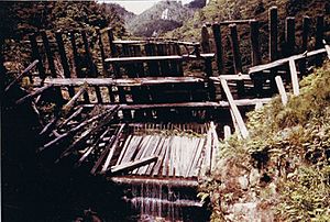
To solve this, workers built special "driving dams" out of wood in stream beds. These dams had a gate at the bottom. When the dam filled with water, sometimes taking up to a year, the gate was opened. The logs would then be pushed out and swept down the stream to the sea.
Much of the original old-growth kauri forest was cut down. Today, most of the island is covered with younger native forests. However, some large kauri trees still remain in the far north of the island.
Other Island Jobs
Great Barrier Island was also home to New Zealand's last whaling station, located at Whangaparapara. It opened in 1956 but closed just six years later in 1962 because there were not enough whales left. You can still visit some of the remains of this station.
Another small industry was digging for kauri gum, which is a resin from kauri trees. Dairy and sheep farming have also been part of the island's economy, though on a smaller scale than in other parts of New Zealand. The fishing industry here also declined when fish prices dropped around the world.
Today, most islanders work in tourism, farming, or other service jobs. Many also work off the island.
Shipwreck Stories
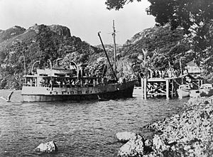
The northern part of the island was the site of a terrible shipwreck. The SS Wairarapa sank there on October 29, 1894, losing about 140 lives. Some of the people who died are buried in two grave sites on the beaches in the far north.
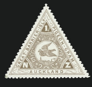
Because of this disaster, a special pigeon post service was started on Great Barrier Island. Pigeons carried messages to the mainland! The first message was flown on May 14, 1897. Special postage stamps were even made for this service from 1898 until 1908. The pigeon post stopped when a new communication cable was laid to the mainland, making the pigeons no longer needed.
Nature Reserves
Over time, more and more of Great Barrier Island has become protected land, managed by the Department of Conservation (DOC). Some of this land has been owned by the government for a long time, while other parts were bought or given as gifts. For example, in 1984, a farmer named Max Burrill gave over 10% of the island to the government. This area includes some of the largest remaining kauri forests.
DOC has created many walking tracks across the island. Some of these tracks are also open for mountain biking. The Aotea Conservation Park is a special place with multi-day walking trails, two DOC huts, and many campsites. This park covers more than 12,000 hectares (29,650 acres) and has trails for all levels of walkers.
Great Barrier Island is special because it doesn't have some of the most harmful introduced animals that cause problems for native wildlife in other parts of New Zealand. While there are wild cats, dogs, pigs, and rats, there are no known populations of possums, stoats, or deer. This makes the island a safe place for many rare native birds and plants. Some of the rare animals found here include brown teal ducks, black petrel seabirds, and kaka parrots.
Marae on Aotea
Great Barrier Island has two marae, which are traditional Māori meeting places. These marae are connected to the local iwi (tribe) of Ngāti Rehua and Ngātiwai. They are called Kawa Marae (with its Rehua meeting house) and Motairehe Marae (with its Whakaruruhau meeting house).
Dark Sky Sanctuary
In 2017, Aotea / Great Barrier Island was recognized as a Dark Sky Sanctuary by the International Dark-Sky Association. This means the island has incredibly dark night skies, perfect for stargazing and astrophotography! It was the third place in the world to get this special title and the very first island sanctuary. This helps people appreciate and protect the island's dark skies for a long time.
Island Population
In 2018, about 930 people lived on Great Barrier Island. The population changes throughout the year, growing a lot from October to May as many visitors come for holidays. The island has become a popular place to visit in the darker months because of its amazing dark skies, which are perfect for stargazing.
Most houses on the island use solar panels and batteries for electricity. Wind and water turbines, along with solar water heaters, are also used. Diesel generators, which used to be the main power source, are now mostly used as a backup.
Island Settlements
Most of the people on Great Barrier Island live in small towns along the coast. Tryphena, in the south, is the largest settlement. Other communities include Okupu and Whangaparapara in the southwest, Port Fitzroy and Okiwi in the north, and Claris and Medlands in the southeast.
Getting Around the Island
There are two small airports on the island: Great Barrier Aerodrome at Claris and Okiwi Airfield. Several airlines offer flights from Auckland Airport and North Shore Aerodrome to Claris, and some also fly to Okiwi. The flight takes about 35 minutes from Auckland.
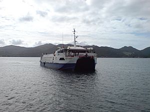
You can also take a ferry to the island. SeaLink operates a ferry that carries passengers, cars, and freight from Wynyard Wharf in Auckland to Tryphena. This ferry trip takes about four and a half hours. Other options include fast ferries and helicopter services.
Island Schools and Services
The Auckland Council provides most of the services and facilities on the island, like roads and wharves.
There are three primary schools on Great Barrier Island: Mulberry Grove School in Tryphena, Kaitoke School in Claris, and Okiwi School. There isn't a high school on the island. However, there is a learning hub that helps students who learn through the New Zealand Correspondence School. Many older children leave the island to attend boarding schools on the mainland.
See also
 In Spanish: Isla Gran Barrera para niños
 | Laphonza Butler |
 | Daisy Bates |
 | Elizabeth Piper Ensley |


