Whanganui Airport facts for kids
Quick facts for kids
Whanganui Airport
|
|||||||||||||||||||||||||||
|---|---|---|---|---|---|---|---|---|---|---|---|---|---|---|---|---|---|---|---|---|---|---|---|---|---|---|---|
| Summary | |||||||||||||||||||||||||||
| Location | Whanganui, New Zealand | ||||||||||||||||||||||||||
| Elevation AMSL | 27 ft / 8 m | ||||||||||||||||||||||||||
| Coordinates | 39°57′44″S 175°01′31″E / 39.96222°S 175.02528°E | ||||||||||||||||||||||||||
| Map | |||||||||||||||||||||||||||
| Runway | |||||||||||||||||||||||||||
|
|||||||||||||||||||||||||||
|
Source: World Aero Data
|
|||||||||||||||||||||||||||
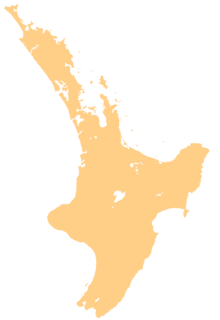
Whanganui Airport is an airport that serves the city of Whanganui in New Zealand. It was known as Wanganui Airport until 2016. The airport is located south of the Whanganui River. It is about 4 kilometers (2.5 miles) from the city center.
The airport first opened in 1954. Flights started arriving and departing in November of that year. For a while, Air New Zealand flew from Whanganui to Wellington and Taupo. However, these flights stopped in December 2013. Another airline, Sounds Air, briefly took over the Wellington route. But these flights also ended in May 2015.
Today, Whanganui Airport has one main building for travelers, called a terminal. This terminal has two gates where passengers get on and off planes. Currently, Air Chathams is the main airline flying from Whanganui to Auckland.
Airlines and Destinations
Whanganui Airport connects travelers to other cities in New Zealand. Only one airline currently flies from here.
| Airlines | Destinations |
|---|---|
| Air Chathams | Auckland |
 | Emma Amos |
 | Edward Mitchell Bannister |
 | Larry D. Alexander |
 | Ernie Barnes |


