Whetstone Creek (Little Nottoway River tributary) facts for kids
Quick facts for kids Whetstone Creek |
|
|---|---|
| Other name(s) | Tributary to Little Nottoway River |
| Country | United States |
| State | Virginia |
| County | Nottoway |
| Physical characteristics | |
| Main source | about 1.5 miles southwest of Martins Corner, Virginia 510 ft (160 m) 37°06′20″N 078°09′33″W / 37.10556°N 78.15917°W |
| River mouth | Little Nottoway River about 2 miles northwest of Blackstone, Virginia 259 ft (79 m) 37°05′06″N 078°02′57″W / 37.08500°N 78.04917°W |
| Length | 8.03 mi (12.92 km) |
| Basin features | |
| Progression | west |
| River system | Nottoway River |
| Basin size | 10.54 square miles (27.3 km2) |
| Tributaries |
|
| Bridges | The Falls Road (VA 49) Snead Spring Road Flat Rock Road The Grove Road |
Whetstone Creek is a small stream in Virginia, United States. It flows for about 10.54 mi (16.96 km) before joining the Little Nottoway River. This creek is part of a much larger water system called the Chowan-Albemarle drainage. This means its water eventually flows into the Albemarle Sound.
About Whetstone Creek
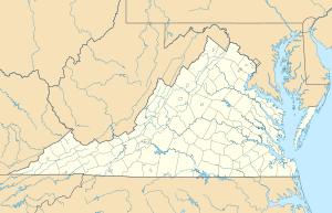
Whetstone Creek is located in the southeastern part of Virginia. It is a "tributary," which means it's a smaller stream that flows into a larger river. In this case, it flows into the Little Nottoway River. The creek starts about 1.5 miles southwest of Martins Corner, Virginia. It then flows generally west until it meets the Little Nottoway River. This meeting point is about 2 miles northwest of Blackstone, Virginia.
The Land Around the Creek
The area of land that drains water into Whetstone Creek is called its "watershed." This watershed covers about 10.54 square miles (27.3 km2). Most of the land in this area is covered by forests, making up about 65% of the watershed. Another 32% of the land is used for farming. The rest of the land has other uses. This mix of forests and farms helps show what the natural environment around the creek is like.
Bridges Over Whetstone Creek
Several roads cross over Whetstone Creek. These bridges help people travel around the area. Some of the roads that cross the creek include:
- The Falls Road (also known as VA 49)
- Snead Spring Road
- Flat Rock Road
- The Grove Road
These crossings are important parts of the local transportation network.
 | Calvin Brent |
 | Walter T. Bailey |
 | Martha Cassell Thompson |
 | Alberta Jeannette Cassell |


