White Oak, Oklahoma facts for kids
Quick facts for kids
White Oak, Oklahoma
|
|
|---|---|
| Country | United States |
| State | Oklahoma |
| County | Craig |
| Area | |
| • Total | 5.97 sq mi (15.46 km2) |
| • Land | 5.95 sq mi (15.40 km2) |
| • Water | 0.02 sq mi (0.06 km2) |
| Elevation | 804 ft (245 m) |
| Population
(2020)
|
|
| • Total | 208 |
| • Density | 34.99/sq mi (13.51/km2) |
| Time zone | UTC-6 (Central (CST)) |
| • Summer (DST) | UTC-5 (CDT) |
| ZIP code |
74301
|
| FIPS code | 40-80850 |
| GNIS feature ID | 2584396 |
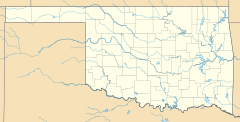
White Oak is a small community in Craig County, Oklahoma, United States. It's not an official city but is recognized as a census-designated place (CDP). This means it's a place where people live that the government counts for population statistics.
White Oak is located along State Highway 66. It's about 1.6 kilometers (one mile) west of where Highway 66 meets U.S. Route 60. In 2020, about 208 people lived in White Oak.
This community is very important to the Shawnee Tribe. They hold their yearly Spring and Fall Bread Dances and Green Corn ceremonies here. These are special events that celebrate their culture and traditions.
History of White Oak
The community of White Oak once had its own post office. It opened on October 14, 1898. The post office served the area for many years before it closed on October 31, 1957.
Population Information
| Historical population | |||
|---|---|---|---|
| Census | Pop. | %± | |
| 2020 | 208 | — | |
| U.S. Decennial Census | |||
According to the 2020 census, the population of White Oak was 208 people. This number helps us understand how many people live in the community.
Schools in White Oak
White Oak has its own school district called White Oak Public Schools. This district is responsible for students from kindergarten all the way through 12th grade.
However, since 2010, the district has made a change. High school students (grades 9-12) from White Oak now attend Vinita Public Schools in a nearby town. White Oak Public Schools now focuses on educating younger students, from Pre-Kindergarten up to 8th grade, right in their own community.
See also
 In Spanish: White Oak (Oklahoma) para niños


