
White Pine, Michigan facts for kids
Quick facts for kids
White Pine, Michigan
|
|
|---|---|

Entry sign to White Pine, Michigan.
|
|

Location within Ontonagon County
|
|

White Pine, Michigan
Location in Michigan

White Pine, Michigan
Location in the United States
|
|
| Country | United States |
| State | Michigan |
| County | Ontonagon |
| Township | Carp Lake |
| Area | |
| • Total | 5.00 sq mi (12.96 km2) |
| • Land | 5.00 sq mi (12.96 km2) |
| • Water | 0.00 sq mi (0.00 km2) |
| Elevation | 899 ft (274 m) |
| Population
(2020)
|
|
| • Total | 339 |
| • Density | 67.77/sq mi (26.17/km2) |
| Time zone | UTC-5 (Eastern (EST)) |
| • Summer (DST) | UTC-4 (EDT) |
| ZIP code(s) |
49971
|
| Area code(s) | 906 |
| GNIS feature ID | 1622143 |
White Pine is a small community in Ontonagon County, Michigan. It is known as an unincorporated community and a census-designated place (CDP). This means it's a recognized area with a name, but it doesn't have its own local government like a city or town.
White Pine is located inside Carp Lake Township. In 2020, about 339 people lived there. The community was mostly built in the 1950s to provide homes for people working at the nearby White Pine mine.
Contents
History of White Pine
White Pine has an interesting past, especially because of its connection to mining. It was once a stop on the Chicago, Minneapolis and St. Paul Railway, which helped connect it to other places.
Early Mining and Settlement
In the early 1900s, a mining engineer named Thomas H. Wilcox discovered a lot of copper in the Mineral River. He then started the White Pine Copper Company to mine this valuable metal. The settlement officially got a post office in June 1915, and it was called "White Pine Mine."
Building a Community for Miners
In the 1950s, the Copper Range Company developed White Pine as a place for miners and their families to live. This was a common practice for copper mines in Michigan. Having homes close by helped workers stay with the company longer. White Pine was designed like a typical neighborhood from that time, with many single-story homes. There were also apartments and a trailer park.
Changes Over Time
However, the community didn't grow as much as the Copper Range Company had hoped. By the 1950s, more people had cars. Workers started preferring to drive longer distances to work from their existing homes instead of moving closer to the mine. This changed how mining communities developed.
Official Recognition
For the first time, White Pine was officially listed as a census-designated place for the 2010 census. This means it now has clear boundaries and its population is counted separately.
Geography and Location
White Pine is located in the western part of Michigan's Upper Peninsula. It covers an area of about 5 square miles (12.96 square kilometers), and all of it is land.
Surroundings and Natural Features
The community is situated within Carp Lake Township. It lies just east of the beautiful Porcupine Mountains Wilderness State Park. This park is known for its stunning forests, waterfalls, and Lake Superior shoreline.
The White Pine Mine
The famous White Pine mine was a major part of the area's history. The Copper Range Company operated this mine in White Pine from 1955 until 1995. It was one of the largest copper mines in Michigan.
Postal Information
White Pine uses the 49971 ZIP Code. This is actually the highest number for a ZIP Code in the entire state of Michigan!
Population and People
The number of people living in White Pine has changed over the years.
| Historical population | |||
|---|---|---|---|
| Census | Pop. | %± | |
| 2020 | 339 | — | |
| U.S. Decennial Census | |||
In 2010, the population was 474 people. By 2020, the population was 339.
Images for kids
-
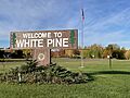
Entry sign to White Pine, Michigan.
-
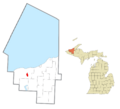
Location within Ontonagon County
See also
 In Spanish: White Pine (Míchigan) para niños
