Whitefish River (Manitoba) facts for kids
Quick facts for kids Whitefish River |
|
|---|---|
|
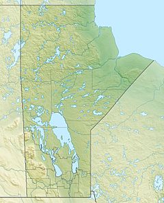
Location of the mouth of the Whitefish River in Manitoba.
|
|
| Country | Canada |
| Province | Manitoba |
| Region | Northern Region |
| Census Division | No. 21 |
| Physical characteristics | |
| Main source | Rocky Lake 260 m (850 ft) 54°04′45″N 101°33′18″W / 54.07917°N 101.55500°W |
| River mouth | Saskatchewan River 256 m (840 ft) 53°51′00″N 101°23′02″W / 53.85000°N 101.38389°W |
| Length | 43 km (27 mi) |
The Whitefish River is a river located in the northern part of Manitoba, Canada. It flows through Census Division 21 in the Northern Region. This river is part of the huge Hudson Bay and Nelson River water systems. It flows into the Saskatchewan River from the left side.
Where the Whitefish River Flows
The Whitefish River starts its journey at a place called Rocky Lake. From there, it flows towards the east until it reaches Root Lake. After Root Lake, the river turns south. It then passes through Reader Lake. Finally, the Whitefish River reaches its end point, which is the Saskatchewan River. This meeting point is just a short distance upstream from a community called Big Eddy Settlement. It is also about 8 kilometres (5 mi) west of the town of The Pas, Manitoba.
Rivers and Creeks Joining In
Several smaller rivers and creeks flow into the Whitefish River. These are called tributaries. They add more water to the main river as it flows.
- Red Rock Creek joins the Whitefish River from the left side.
- Dinner Place Creek flows into the Whitefish River from the right side.
- Rocky Lake is where the Whitefish River begins.
- Maria Creek flows into Rocky Lake, which then feeds the Whitefish River.
 | Selma Burke |
 | Pauline Powell Burns |
 | Frederick J. Brown |
 | Robert Blackburn |


