Whitestown, Indiana facts for kids
Quick facts for kids
Whitestown, Indiana
|
|
|---|---|

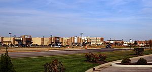
Whitestown's Anson development in 2019
|
|

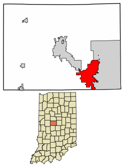
Location of Whitestown in Boone County, Indiana.
|
|
| Country | United States |
| State | Indiana |
| County | Boone |
| Townships | Worth, Perry, Eagle |
| Area | |
| • Total | 14.02 sq mi (36.32 km2) |
| • Land | 14.02 sq mi (36.32 km2) |
| • Water | 0.00 sq mi (0.00 km2) |
| Elevation | 932 ft (284 m) |
| Population
(2020)
|
|
| • Total | 10,178 |
| • Density | 725.81/sq mi (280.23/km2) |
| Time zone | UTC-5 (Eastern (EST)) |
| • Summer (DST) | UTC-4 (EDT) |
| ZIP code |
46075
|
| Area code(s) | 317 |
| FIPS code | 18-84014 |
| GNIS feature ID | 2397741 |
| Website | whitestown.in.gov |
Whitestown is a town in Boone County, Indiana, United States. It is located near Interstate 65, about 22 miles (35 km) northwest of Downtown Indianapolis. The town is between exits 130 and 133 on the interstate. Since 2010, Whitestown has been the fastest-growing town in Indiana. Its population grew more than three times bigger between 2010 and 2020.
Contents
History of Whitestown
Whitestown was first planned out in 1851. This happened when the railroad was built to reach that area. The town was named after Albert Smith White, who was a U.S. Senator from Indiana. Albert S. White was known for being a leading abolitionist, meaning he was against slavery. The first post office in Whitestown opened in 1853.
In the late 2000s, Whitestown grew by adding 6,500 acres of land south of its old downtown area. A new, carefully planned community called Anson was started here in 2005. It was named after Anson Mills, a U.S. Army officer from Boone County. The Great Recession (a time of economic difficulty) slowed down the building of Anson at first. However, homes, shops, and businesses began to grow quickly starting in 2011. This growth is still happening today. The Anson area now has many stores, including large superstores and fashion shops.
From 2010 until now, Whitestown has been the fastest-growing town in Indiana. Its population more than doubled between 2010 and 2017.
Whitestown is also home to the Little League Central Region headquarters. In 2021, a new complex opened there. This complex includes the main office building, a gift shop, and a Little League field. The field has stadium seating, bleachers, a press box, and lights. This complex hosts big tournaments for Little League Softball and Baseball teams from the Great Lakes and Midwest regions.
Geography
According to the 2010 census, Whitestown covers a total area of 10.46 square miles (27.1 square kilometers). All of this area is land.
Transportation
Getting Around Whitestown
The Central Indiana Regional Transportation Authority runs a bus service. This bus helps people get to major employers in the town.
Main Roads
Airports Nearby
There are no airports directly inside Whitestown. The closest public airports are:
- Boone County Airport: This airport is about 5.1 miles (8.2 km) northwest of Whitestown's old downtown.
- Indianapolis Executive Airport: This airport is about 5.6 miles (9.1 km) northeast of Whitestown.
The closest large airport with regular flights is Indianapolis International Airport (IND). It is about 25 miles (40 km) south of Whitestown.
Trails and Old Railroads
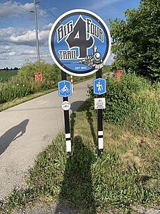
An old railroad line used to run through Whitestown. It was built in 1851 and stopped being used in 1976. In 2015, Whitestown started turning parts of this old railroad line into a shared path for walking and biking. This path is called the Big 4 Heritage Trail. It goes through different parts of Boone County, including nearby Lebanon and Zionsville. Whitestown's part of the trail is 2.4 miles (3.9 km) long. In April 2022, Whitestown received money to finish its part of the Big 4 Trail. This will add more sections to the trail, and the project is expected to be finished in 2023.
Population Growth
| Historical population | |||
|---|---|---|---|
| Census | Pop. | %± | |
| 1950 | 550 | — | |
| 1960 | 613 | 11.5% | |
| 1970 | 569 | −7.2% | |
| 1980 | 497 | −12.7% | |
| 1990 | 476 | −4.2% | |
| 2000 | 471 | −1.1% | |
| 2010 | 2,867 | 508.7% | |
| 2020 | 10,178 | 255.0% | |
| U.S. Decennial Census | |||
Whitestown has seen a lot of growth in its population. In 2010, there were 2,867 people living in the town. By 2020, the population had grown to 10,178 people. This shows how quickly the town has expanded in recent years.
Education
Students in Whitestown attend public schools run by two different systems. Those in Worth Township and Perry Township go to schools managed by Lebanon Community School Corporation. Students in Eagle Township attend Zionsville Community Schools.
Traders Point Christian School is a private school for students from kindergarten through 12th grade. It is also located in Whitestown.
The Hussey-Mayfield Memorial Public Library opened a new branch in Whitestown in 2024.
See also
 In Spanish: Whitestown (Indiana) para niños
 | Claudette Colvin |
 | Myrlie Evers-Williams |
 | Alberta Odell Jones |


