Downtown Indianapolis facts for kids
Quick facts for kids
Downtown Indianapolis
|
|
|---|---|
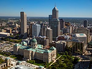
Downtown Indianapolis in 2016
|
|
| Nickname(s):
"Downtown Indy"
|
|
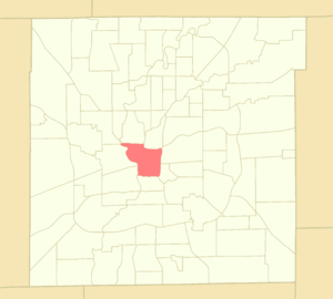
Location of Downtown within Indianapolis–Marion County, Indiana
|
|
| Country | United States |
| State | Indiana |
| County | Marion |
| Township | Center |
| City | Indianapolis |
| Population
(2020)
|
|
| • Total | 22,412 |
| Time zone | UTC−5 (EST) |
| • Summer (DST) | UTC−4 (EDT) |
| ZIP code |
46202, 46203, 46204, 46225
|
| Area code(s) | 317 / 463 |
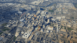
Downtown Indianapolis is the main part of Indianapolis, Indiana, in the United States. It's like the city's heart, where lots of important things happen. Downtown is surrounded by major highways, I-65 and I-70, and the White River. It's also close to the very center of Marion County.
This area started as a small planned town in 1821, called the Mile Square. Over time, it grew much bigger. Today, Downtown Indianapolis is the main place for culture, government, and business in the whole Indianapolis metropolitan area. It's a popular spot for visitors, with many hotels, sports venues, and places for events. You can find historic buildings, memorials, museums, and theaters here. It's also where the city and state governments are located, and it has the most offices and jobs in Indiana.
Contents
Where is Downtown Indianapolis?
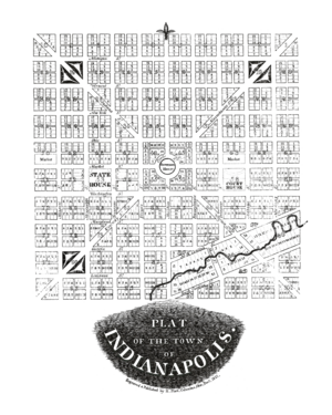
When Indianapolis was first planned in 1820, it was meant to be a 1-square-mile area. This area was next to the White River and near the center of Marion County. The plan included important spots like the Indiana Statehouse (the state government building) and the Indianapolis City Market. As more people moved in, this original area became the city's main business district.
This historic center is often called the "Mile Square." But the Downtown "neighborhood area" is actually much larger. It stretches from 16th Street and I-65 in the north, to I-65/70 in the east, I-70 in the south, and the White River in the west. Downtown is usually split into four parts by two main streets: Meridian Street (north-south) and Washington Street (east-west).
Downtown Indianapolis is built on flat land. It's near where the White River and Fall Creek meet. A smaller stream called Pogue's Run flows underneath Downtown in a special tunnel built in 1914.
Downtown Neighborhoods and Districts
Downtown Indianapolis has many smaller neighborhoods and special areas. Some of these are even listed on the National Register of Historic Places. Areas in italics are known as cultural districts.
- Canal and White River State Park
- Chatham–Arch
- Cole-Noble District
- Flanner House Homes
- Fletcher Place
- Holy Rosary
- Indiana Avenue
- Indiana World War Memorial Historic District
- Lockefield Gardens
- Lockerbie Square
- Market East
- Massachusetts Avenue
- Old Southside
- Ransom Place
- St. Joseph
- Washington Street–Monument Circle Historic District
- Wholesale District
History of Downtown Indianapolis
Downtown Indianapolis began when the city was founded in 1820. It was chosen as the new capital of Indiana. Two people, Alexander Ralston and Elias Pym Fordham, designed the town plan in 1821. Ralston's plan for Indianapolis was a 1-square-mile area. It had a large circular park, Governor's Circle, in the middle.
The plan used a grid pattern with wide roads and public squares. Four diagonal streets, now called avenues, also crossed the grid. Some squares were set aside for government use. Ralston's basic street plan is still used in Downtown Indianapolis today. Streets in the original plan were named after U.S. states. Later, Tennessee and Mississippi Streets were renamed Capitol and Senate Avenues. This happened after state government buildings were built near the Indiana Statehouse.
The city's address system starts at the corner of Washington and Meridian streets. Washington Street is also part of the National Road, a famous old highway.
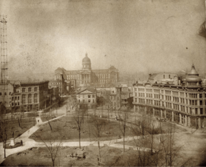
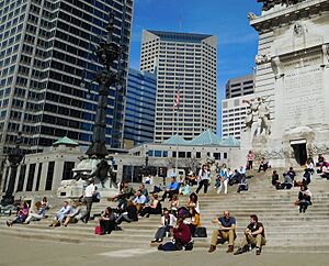
In the late 1800s, Indianapolis grew a lot. Its population jumped from about 8,000 in 1850 to over 169,000 in 1900. The city changed from a farming community to an industrial center. Many famous buildings still standing Downtown were built then. These include the Soldiers' and Sailors' Monument (finished 1902), the Indiana Statehouse (1888), Union Station (1888), and the Das Deutsche Haus (1898).
After World War II, many people moved from cities to suburbs. This affected Downtown Indianapolis, like many other city centers. Old neighborhoods were cleared for new projects. The areas around Indiana Avenue, which was a center for the city's African American community, were especially changed. The creation of the Indiana University–Purdue University Indianapolis (IUPUI) campus in 1969 and the building of I-65 and I-70 in the 1960s and 1970s caused many African Americans to be displaced.
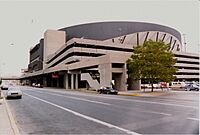
To help Downtown grow again, city leaders started new projects. One of the first was Market Square Arena, which opened in 1974. It was home to the Indiana Pacers basketball team. Its success led to a plan to make Downtown a center for sports tourism. In the 1980s, new sports places were built. These included the Indianapolis Tennis Center, Indiana University Natatorium, and the Hoosier Dome. The Hoosier Dome helped bring the Baltimore Colts football team to Indianapolis in 1984. It also hosted the 1987 Pan American Games and many other big sports events.
In the 1980s, many tall buildings were built Downtown. Six of the city's ten tallest buildings were constructed between 1982 and 1990. These include the Salesforce Tower (1990), which is the tallest.
The non-profit Downtown Indy, Inc. started in 1993. It helps promote business, improve the area, and plan events. More development happened in the 1990s. This included attractions at White River State Park, the Canal Walk, Circle Centre Mall (1995), Victory Field (1996), and Gainbridge Fieldhouse (1999).
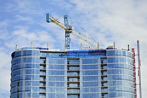
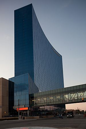
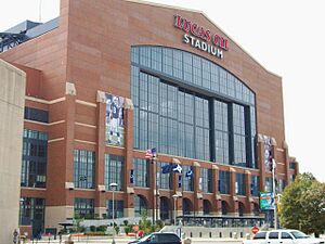
The city's success with sports tourism helped it attract more conventions. Two of the tallest buildings built in the 2000s were hotels: Conrad Indianapolis (2006) and the JW Marriott Indianapolis (2011). After Lucas Oil Stadium opened in 2008, the Indiana Convention Center got its biggest expansion in 2011.
In the 2010s, more people wanted to live Downtown. Many new apartment buildings were built. From 2011 to 2015, the number of apartments Downtown grew by 61 percent. The population of Downtown also increased from 14,664 in 2010 to 22,412 in 2020.
Downtown Indianapolis Economy
Downtown is where most jobs are located in Indiana. In 2021, about 154,500 people worked Downtown. It has over 11 million square feet of office space.
Downtown Indianapolis is home to two of the city's largest companies: Elevance Health (health insurance) and Eli Lilly and Company (medicine). Other big employers Downtown include AES Indiana, Cummins, Rolls-Royce, Indiana University, IU Health, Angi, and Salesforce.
Hotels and Tourism
Tourism is a very important part of Indianapolis's economy, especially Downtown. In 2015, 28.2 million visitors came to the city. Indianapolis is known for sports tourism, but it also hosts many conventions. The Indiana Convention Center (ICC) and Lucas Oil Stadium are huge places for events. They have a combined 750,000 square feet of space. The ICC is connected to 12 hotels and 4,700 hotel rooms.
Most hotels are near the Indiana Convention Center. Downtown Indianapolis has 34 hotels with a total of 7,839 rooms. Some well-known hotels include:
- The Columbia Club
- Conrad Indianapolis
- Hilton Garden Inn Indianapolis Downtown
- Hilton Indianapolis
- Hyatt Regency Indianapolis
- Indianapolis Marriott Downtown
- JW Marriott Indianapolis
- Le Méridien Indianapolis Hotel
- Omni Severin Hotel
Things to Do in Downtown Indianapolis
Recent projects in Downtown Indianapolis include new tall buildings and a big expansion of the Indiana Convention Center in 2011. The Indianapolis Cultural Trail opened in 2013 after years of planning. This 8-mile path for bikes and walkers connects six cultural districts. It links to IUPUI and many arts, cultural, sports, and entertainment places Downtown.
Places to Eat Downtown
You can find famous local restaurants like St. Elmo Steak House and Slippery Noodle Inn near Circle Centre Mall in the Wholesale District. Massachusetts Avenue has many local bars and eateries. The Indianapolis City Market in the Market East district has many food vendors, especially for lunch. Sun King Brewing is also nearby. Since the 2010s, the Fletcher Place neighborhood has become a popular spot for dining.
Entertainment and Sports
Sports Venues Downtown
Indianapolis's professional sports teams play Downtown. These include the Indiana Fever and Indiana Pacers at Gainbridge Fieldhouse. The Indianapolis Colts play at Lucas Oil Stadium. The Indianapolis Indians baseball team plays at Victory Field. Other sports venues are on the Indiana University Indianapolis campus. The IU Indy Jaguars play at the IUPUI Gymnasium, Indiana University Natatorium, and Carroll Stadium. Carroll Stadium is also home to the Indy Eleven soccer team.
Performing Arts Theaters
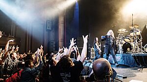
Downtown Indianapolis has many places to enjoy live performances:
- Athenæum (Das Deutsche Haus)
- The Cabaret
- The District Theatre
- Everwise Amphitheater at White River State Park
- Hilbert Circle Theatre (Indianapolis Symphony Orchestra)
- Indiana Theatre (Indiana Repertory Theatre)
- Indianapolis Artsgarden
- IndyFringe Basile and Indy Eleven Theatres
- Madam Walker Legacy Center
- Old National Centre
- The Pavilion at Pan Am
- Phoenix Theatre
Monuments and Memorials
Downtown Indianapolis is home to many important monuments and memorials:
Museums and Libraries
You can find many museums and libraries Downtown. These include the Indiana Historical Society and Indiana State Museum, both on the Canal Walk. The state's largest public library, the Indiana State Library and Historical Bureau, is also nearby. White River State Park has the Eiteljorg Museum of American Indians and Western Art and the NCAA Hall of Champions.
On Indiana Avenue, you'll find the Crispus Attucks High School and Museum and the Kurt Vonnegut Museum and Library. The Mass Ave Cultural Arts District has the Indianapolis Firefighters Museum and James Whitcomb Riley Museum Home. The Rhythm! Discovery Center is also Downtown.
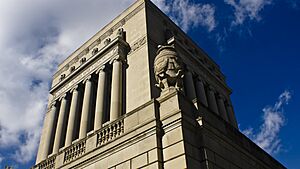
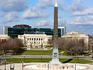
Two major Masonic buildings, the Indianapolis Masonic Temple and Scottish Rite Cathedral, are on North Street. Across Meridian Street is the Indianapolis Public Library's Central Library and the Indiana World War Memorial Plaza. This plaza includes the American Legion's Emil A. Blackmore Museum, the Indiana World War Memorial Military Museum, and the Colonel Eli Lilly Civil War Museum.
Public Parks and Spaces
In 2021, Downtown Indianapolis had about 340 acres of parks and plazas. The Indiana World War Memorial Plaza includes three green spaces: American Legion Mall, Veterans Memorial Plaza, and University Park. The Indianapolis Canal Walk also has small parks. Bicentennial Unity Plaza, a new public space, opened in 2023.
Note: Some parks listed below are privately owned or not managed by the state or city.
- Babe Denny Park
- Ball Nurses' Sunken Garden and Convalescent Park
- Bicentennial Plaza
- Bicentennial Unity Plaza
- Bill Gray Plaza
- Charles L. Whistler Memorial Plaza
- Chatham Commons
- Cummins Central Plaza
- Edna Balz Lacy Family Park
- Fallen Firefighters Memorial Plaza
- Hudnut Commons
- Indianapolis Cultural Trail
- Lt. Jr. Gr. Graham Edward Martin Park
- Matthew R. Gutwein Commonground at Eskenazi Health
- Merrill Street Pocket Park
- Military Park
- Monument Circle
- Pathways to Peace Garden
- Presidential Place Park
- Ransom Place Neighborhood Park
- Richard G. Lugar Plaza
- South Street Square Park
- White River Greenway
- White River State Park
Education in Downtown Indianapolis
Downtown's northwest area is home to Indiana University–Purdue University Indianapolis (IUPUI). About 30,000 students attend IUPUI. They can choose from 450 different programs. Important schools on campus include the Herron School of Art and Design, Kelley School of Business, McKinney School of Law, and the Indiana University School of Medicine. The School of Medicine is the largest medical school in the U.S.
Two public schools from Indianapolis Public Schools (IPS) serve the Downtown area: Center for Inquiry School 2 and Crispus Attucks High School. The Simon Youth Foundation also runs an alternative school for older high school students at Circle Centre Mall. There is one private school, Lumen Christi Catholic School, in the Fletcher Place neighborhood.
Hospitals in Downtown Indianapolis
Downtown's northwest area has the most hospitals and healthcare facilities in the region. Indiana University Health and the Indiana University School of Medicine form a major medical center. This includes University Hospital and Riley Hospital for Children. These are located near 10th Street, Michigan Street, University Boulevard, and Riley Hospital Drive. IU Health Methodist Hospital is also nearby on 16th Street.
The city's main public hospitals, Sidney & Lois Eskenazi Hospital and the Richard L. Roudebush VA Medical Center, are just west of the Indiana University Medical Center.
Transportation in Downtown Indianapolis
Downtown Indianapolis has always been a main transportation center for central Indiana. The National Road (now Washington Street), a major early highway, reached Indianapolis in 1836. The first railroad arrived in 1847. Indianapolis Union Station opened in 1853. It was the world's first union station, meaning many different train companies used it.
In 1864, the city got its first mule-drawn streetcar line. Later, the Indianapolis Traction Terminal opened in 1904. It was the biggest interurban (electric train) station in the world. It handled 500 trains and 7 million passengers each year. But cars became more popular, and the terminal closed in 1941. The streetcar system stopped in 1957.
Two of the region's four interstate highways, Interstate 65 and Interstate 70, form a loop around Downtown Indianapolis. These highways connect Downtown to the "outer loop," which is Interstate 465.
IndyGo runs the city's public bus system. Downtown Indianapolis is the main hub for most bus routes. The Julia M. Carson Transit Center opened in 2016 as the Downtown hub for 27 bus routes.
Downtown Indianapolis is still a hub for travel between cities. Amtrak offers train service with the Cardinal train. It travels between New York City and Chicago three times a week. Union Station served about 30,000 train passengers in 2015. Three bus companies also stop in the city: Greyhound Lines, Burlington Trailways (at Union Station), and Megabus (at City Market).
The Indianapolis Airport Authority also operates the Indianapolis Downtown Heliport, which opened in 1979 for public use.
Images for kids
 | Jackie Robinson |
 | Jack Johnson |
 | Althea Gibson |
 | Arthur Ashe |
 | Muhammad Ali |


