Widgiewa, New South Wales facts for kids
Quick facts for kids WidgiewaNew South Wales |
|
|---|---|

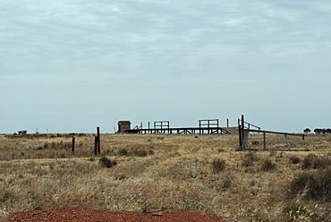
Abandoned rail siding at Widgiewa
|
|
| Postcode(s) | 2700 |
| Elevation | 112 m (367 ft) |
| Location | |
| LGA(s) | Federation Council |
| County | Urana |
| State electorate(s) | Albury |
| Federal Division(s) | Farrer |
Widgiewa is a small community located in the central part of the Riverina region in New South Wales, Australia. It is a quiet place with an interesting past.
Where is Widgiewa?
Widgiewa is found in the Riverina area of New South Wales. You can reach it by road. It is about 9 kilometers (5.6 miles) southwest of Morundah. It is also about 25 kilometers (15.5 miles) northeast of Bundure.
Widgiewa's History
The name Widgiewa comes from an Aboriginal word. It means "What do you want?". This shows the deep history of the land.
The Railway Station
Widgiewa was once a stop on the Tocumwal railway line. The train station first opened on September 16, 1884. It helped connect the community to other places. The station closed many years later, on May 4, 1975.
The Post Office
A Post Office also served the Widgiewa community. It opened on March 15, 1912. People could send and receive mail there. The Post Office closed its doors in 1970.
 | Charles R. Drew |
 | Benjamin Banneker |
 | Jane C. Wright |
 | Roger Arliner Young |


