Wilkinson Creek (Haw River tributary) facts for kids
Quick facts for kids Wilkinson Creek |
|
|---|---|
 |
|
|
Location of Wilkinson Creek mouth
|
|
| Other name(s) | Tributary to Haw River |
| Country | United States |
| State | North Carolina |
| County | Chatham |
| Physical characteristics | |
| Main source | divide between Wilkinson Creek and Neville Creek about 1 mile east of Terrells Mountain 580 ft (180 m) 35°51′23″N 079°09′06″W / 35.85639°N 79.15167°W |
| River mouth | Haw River about 1 mile northwest of Bynum, North Carolina 320 ft (98 m) 35°46′57″N 079°09′46″W / 35.78250°N 79.16278°W |
| Length | 7.77 mi (12.50 km) |
| Basin features | |
| Progression | south |
| River system | Haw River |
| Basin size | 9.09 square miles (23.5 km2) |
| Tributaries |
|
| Bridges | Wilkinson Creek Lane, Gilmore Road, Lamont Norwood Road, Tobacco Road, Manns Chapel Road, Andrews Store Road, Hamlets Chapel Road |
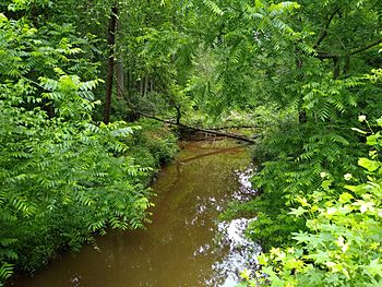
Wilkinson Creek is a small stream, about 7.77 mi (12.50 km) long, located in Chatham County, North Carolina. It's a "second-order tributary," which means it flows into another stream (a first-order tributary) before that stream joins a larger river. In this case, Wilkinson Creek flows directly into the Haw River.
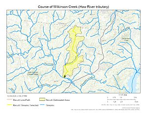
Where Wilkinson Creek Flows
Wilkinson Creek begins its journey about 1 mile east of a place called Terrells Mountain in Chatham County. From there, it flows generally south. Its path ends when it joins the Haw River, just upstream from the town of Bynum.
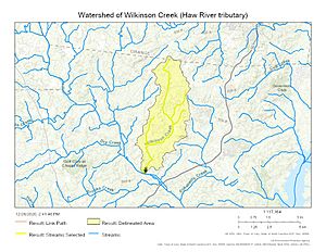
The Wilkinson Creek Watershed
A watershed is like a giant bowl where all the rain and snow that falls eventually drains into one main stream or river. The Wilkinson Creek watershed covers an area of about 9.09 square miles (23.5 km2). This area gets a good amount of rain each year, about 47.4 inches.
Most of the land in this watershed, about 77%, is covered by forests. This is good because forests help keep the water clean and healthy for plants and animals.
Maps of Wilkinson Creek
These maps help you see where Wilkinson Creek is and how its watershed looks.
 | Shirley Ann Jackson |
 | Garett Morgan |
 | J. Ernest Wilkins Jr. |
 | Elijah McCoy |


