
Wilson River (Queensland) facts for kids
Quick facts for kids Wilson |
|
|---|---|

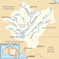
Map of the Lake Eyre basin
|
|

Location of the river mouth in Queensland
|
|
| Country | Australia |
| State | Queensland |
| Region | Channel Country, Western Qld |
| Physical characteristics | |
| Main source | Grey Range Oonagie Sandhill 69 m (226 ft) |
| River mouth | confluence with the Cooper Creek Depot Camp (Camp 63) 27 m (89 ft) 27°48′S 142°11′E / 27.800°S 142.183°E |
| Length | 28 km (17 mi) |
| Basin features | |
| River system | Lake Eyre basin |
| Tributaries |
|
| Waterhole | Nockanoora |
The Wilson River is a special kind of river in Western Queensland, Australia. It's part of the huge Lake Eyre basin and is known as an ephemeral river. This means it doesn't always have water flowing in it. It only flows after heavy rains, often during the wet season.
It's located in an area called the Channel Country. This region is famous for its many river channels and floodplains that spread out when it rains.
Contents
Where the River Starts and Ends
The Wilson River begins on the slopes of the Grey Range, which is a mountain range. It starts near a place called Oonagie Sandhill.
The River's Journey
From its start, the river flows mostly towards the northwest. Along its path, it goes through a waterhole called Nockanoora (sometimes spelled Noccundra). A waterhole is like a natural pond where water collects, even when the rest of the riverbed is dry.
Two smaller streams, called tributaries, join the Wilson River along its way. These streams add more water to the river when they flow.
Joining Cooper Creek
The Wilson River's journey ends when it meets another river called Cooper Creek. This meeting point is called a confluence. It's located at a spot once known as Depot Camp (or Camp 63).
The river drops about 8 meters (26 feet) in height over its entire 28-kilometer (17-mile) length. This gentle slope helps the water flow across the flat landscape.
A Bit of History
The Wilson River area has a connection to an important part of Australian exploration history.
Burke and Wills Expedition
It's believed that the famous explorers Burke and Wills were the first Europeans to find water on the Macleay Plains. They crossed Cooper Creek near where it joins the Wilson River. This happened on November 11, 1860, during their difficult journey across Australia. Finding water was crucial for their survival in the harsh outback.
Images for kids
-
Map of the Lake Eyre basin
