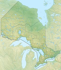
Winisk Lake facts for kids
Quick facts for kids Winisk Lake |
|
|---|---|
| lac Winisk | |
| Location | Kenora District, Canada |
| Coordinates | 52°54′35″N 87°23′03″W / 52.90972°N 87.38417°W |
| Part of | Hudson Bay drainage basin |
| Primary inflows |
|
| Primary outflows | Winisk River |
| Max. length | 35 km (22 mi) |
| Max. width | 19 km (12 mi) |
| Surface elevation | 193 m (633 ft) |
| Settlements | Webequie First Nation |
Winisk Lake (also known as lac Winisk in French) is a really big lake in Ontario, Canada. It's located in the northwestern part of the province, in an area called the Unorganized Part of Kenora District.
This lake is a key part of the Hudson Bay drainage basin. This means its waters eventually flow into Hudson Bay, a large body of saltwater in northeastern Canada.
Exploring Winisk Lake
Winisk Lake is quite large and has an interesting, uneven shape. It stretches about 35 kilometres (22 mi) long and 19 kilometres (12 mi) wide. The lake sits at an elevation of 193 metres (633 ft) above sea level.
Rivers Flowing In and Out
Many rivers help fill Winisk Lake. The main rivers flowing into the lake are:
- The Winisk River from the northeast
- The Wapitotem River from the south
- The Fishbasket River from the southwest
The main river flowing out of the lake is also the Winisk River. It leaves the lake from the north and continues its journey all the way to Hudson Bay.
Life on Eastwood Island
Right in the middle of Winisk Lake is an island called Eastwood Island. This island is home to the Webequie First Nation community. The community is also known simply as Webequie, Ontario.
The Webequie First Nation has an airport on Eastwood Island. This airport is very important for connecting the community to other parts of Ontario and Canada, as it's often the main way to travel to and from this remote area.
 | Jackie Robinson |
 | Jack Johnson |
 | Althea Gibson |
 | Arthur Ashe |
 | Muhammad Ali |


