Wormleysburg, Pennsylvania facts for kids
Quick facts for kids
Wormleysburg, Pennsylvania
|
||
|---|---|---|
|
Borough
|
||

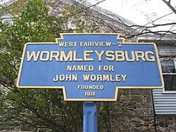
Keystone Marker
|
||
|
||
| Motto(s):
A Capitol Reflection
|
||

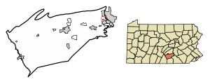
Location of Wormleysburg in Cumberland County, Pennsylvania
|
||
| Country | United States | |
| State | Pennsylvania | |
| County | Cumberland | |
| Settled | 1772 | |
| Incorporated | 1916 | |
| Government | ||
| • Type | Borough Council | |
| Area | ||
| • Total | 0.79 sq mi (2.04 km2) | |
| • Land | 0.78 sq mi (2.01 km2) | |
| • Water | 0.01 sq mi (0.03 km2) | |
| Elevation | 338 ft (103 m) | |
| Population
(2010)
|
||
| • Total | 3,070 | |
| • Estimate
(2019)
|
3,054 | |
| • Density | 3,930.50/sq mi (1,518.46/km2) | |
| Time zone | UTC-5 (Eastern (EST)) | |
| • Summer (DST) | UTC-4 (EDT) | |
| ZIP Codes |
17043, 17011
|
|
| Area code(s) | 717 223 | |
| FIPS code | 42-86528 | |
Wormleysburg is a small town, known as a borough, in Cumberland County, Pennsylvania. It is located in the United States. In 2010, about 3,070 people lived there.
Wormleysburg is part of the larger Harrisburg–Carlisle area. Students in Wormleysburg attend schools in the West Shore School District. The borough is also home to a company called Harsco Corporation.
Contents
History of Wormleysburg
Wormleysburg got its name from its founder, a man named John Wormley. The community was officially made a borough in May 1916. Before that, it was part of East Pennsboro Township.
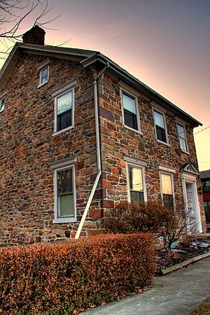
A special building in the town, the John Wormley House, was added to the National Register of Historic Places in 1976. This means it is an important historical place that is protected.
Geography and Location
Wormleysburg is located on the eastern edge of Cumberland County. It sits right on the west bank of the Susquehanna River. Across the river is Harrisburg, which is the capital city of Pennsylvania.
To the north and west, Wormleysburg shares a border with East Pennsboro Township. To the south, it borders the borough of Lemoyne.
Travel and Roads
Two main roads, U.S. Routes 11 and 15, go through Wormleysburg. These roads can take you north to Interstate 81. They also lead southwest through Camp Hill.
Two bridges connect Wormleysburg to Harrisburg across the Susquehanna River. These are the M. Harvey Taylor Memorial Bridge and the Market Street Bridge.
Land and Water Area
According to the U.S. Census Bureau, Wormleysburg covers a total area of about 2.1 square kilometers. Most of this area is land. Only a small part, about 0.03 square kilometers, is water.
Population and People
| Historical population | |||
|---|---|---|---|
| Census | Pop. | %± | |
| 1880 | 297 | — | |
| 1890 | 555 | 86.9% | |
| 1910 | 809 | — | |
| 1920 | 866 | 7.0% | |
| 1930 | 1,404 | 62.1% | |
| 1940 | 1,454 | 3.6% | |
| 1950 | 1,511 | 3.9% | |
| 1960 | 1,794 | 18.7% | |
| 1970 | 3,192 | 77.9% | |
| 1980 | 2,796 | −12.4% | |
| 1990 | 2,847 | 1.8% | |
| 2000 | 2,607 | −8.4% | |
| 2010 | 3,070 | 17.8% | |
| 2019 (est.) | 3,054 | −0.5% | |
| Sources: | |||
In 2000, there were 2,607 people living in Wormleysburg. These people lived in 1,295 households. A household is a group of people living together in one home.
About 19.4% of households had children under 18 years old. Many households were married couples living together. About 39.9% of all households were made up of people living alone.
The population of Wormleysburg is spread out across different age groups. About 17.7% of the people were under 18 years old. About 16.0% were 65 years old or older. The average age of people in Wormleysburg was 38 years.
See also
 In Spanish: Wormleysburg para niños
 | Selma Burke |
 | Pauline Powell Burns |
 | Frederick J. Brown |
 | Robert Blackburn |


