Wright, Kansas facts for kids
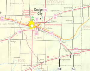
Wright is a small community in Ford County, Kansas, in the United States. It's called a census-designated place (CDP) because it's a special area defined for counting people. In 2020, about 145 people lived there. You can find Wright along Highway 50.
Quick facts for kids
Wright, Kansas
|
|
|---|---|

|
|
| Country | United States |
| State | Kansas |
| County | Ford |
| Named for | Robert Wright |
| Area | |
| • Total | 2.06 sq mi (5.33 km2) |
| • Land | 2.06 sq mi (5.33 km2) |
| • Water | 0 sq mi (0.0 km2) |
| Elevation | 2,530 ft (770 m) |
| Population
(2020)
|
|
| • Total | 145 |
| • Density | 70.46/sq mi (27.20/km2) |
| Time zone | UTC-6 (CST) |
| • Summer (DST) | UTC-5 (CDT) |
| ZIP code |
67882
|
| Area code | 620 |
| FIPS code | 20-80500 |
| GNIS ID | 2629188 |
Contents
The Story of Wright
Wright got its name from a man named Robert M. Wright. He was an important person in Kansas history. From 1875 to 1883, he was a member of the Kansas House of Representatives. This is a group of people who make laws for the state of Kansas. Robert M. Wright also helped start Dodge City and was one of its first mayors.
Where Wright Is Located
Wright is found in Kansas, about 7 miles (11 km) east of Dodge City. It's located right along two important roads: U.S. Route 50 and U.S. Route 56. These highways help people travel to and from the community.
Wright's Weather
The weather in Wright has hot and humid summers. The winters are usually mild to cool. According to a system that classifies climates, Wright has a humid subtropical climate. This means it gets a good amount of rain throughout the year. It also has warm temperatures for much of the year.
How Many People Live Here
The number of people living in Wright changes over time. Counting people helps us understand communities better.
| Historical population | |||
|---|---|---|---|
| Census | Pop. | %± | |
| 2010 | 163 | — | |
| 2020 | 145 | −11.0% | |
| U.S. Decennial Census | |||
Schools in Wright
Children in Wright go to public schools managed by the Dodge City USD 443 school district.
See also
 In Spanish: Wright (Kansas) para niños
 | Misty Copeland |
 | Raven Wilkinson |
 | Debra Austin |
 | Aesha Ash |


