
Ford County, Kansas facts for kids
Quick facts for kids
Ford County
|
|
|---|---|

Ford County Courthouse in Dodge City (2009)
|
|

Location within the U.S. state of Kansas
|
|
 Kansas's location within the U.S. |
|
| Country | |
| State | |
| Founded | February 26, 1867 |
| Named for | James Ford |
| Seat | Dodge City |
| Largest city | Dodge City |
| Area | |
| • Total | 1,099 sq mi (2,850 km2) |
| • Land | 1,098 sq mi (2,840 km2) |
| • Water | 0.8 sq mi (2 km2) 0.07%% |
| Population
(2020)
|
|
| • Total | 34,287 |
| • Density | 31.2/sq mi (12.0/km2) |
| Time zone | UTC−6 (Central) |
| • Summer (DST) | UTC−5 (CDT) |
| Congressional district | 1st |
Ford County is a county in the state of Kansas. It is known for its rich history, especially its connection to the American Old West. The main city and county seat is Dodge City.
In 2020, about 34,287 people lived in Ford County. The county was named after James Ford, a general who served during the American Civil War.
Contents
History of Ford County
Ford County has a long and interesting past. It was once home to some of the earliest military forts in Kansas.
Early Forts and Trails
One of the first military posts was Fort Atkinson. Later, Fort Dodge was built in 1864 near the Arkansas River. This fort was very important for protecting travelers.
Thousands of gold seekers passed through this area in 1849. They were heading to California during the Gold Rush. They traveled along the famous Santa Fe Trail. However, not many people settled here at that time.
Founding the County and Dodge City
Ford County was officially created in 1867. It was named after Colonel James H. Ford. He was in charge of building Fort Dodge after the Civil War. Pioneers had used the Santa Fe Trail through this region since the early 1800s.
The town of Dodge City started in 1872. This happened when the Atchison, Topeka & Santa Fe Railroad was completed. At first, Dodge City was a big center for shipping buffalo hides.
Later, from 1875 to 1885, Dodge City became a famous "cowtown." It was a busy place where cowboys brought cattle on long drives.
Geography and Location
Ford County covers a total area of about 1,099 square miles. Most of this area, about 1,098 square miles, is land. Only a very small part, about 0.8 square miles, is water.
Neighboring Counties
Ford County shares its borders with several other counties:
- Hodgeman County (to the north)
- Edwards County (to the northeast)
- Kiowa County (to the east)
- Clark County (to the south)
- Meade County (to the southwest)
- Gray County (to the west)
Major Roads and Highways
Several important highways run through Ford County, connecting it to other parts of Kansas and beyond:
 U.S. Route 50
 U.S. Route 54
 U.S. Route 56
 U.S. Route 283
 U.S. Route 400
 K-34
K-34
Population Over Time

The population of Ford County has grown a lot over the years. Here's a look at how many people have lived here during different census years:
- 1870: 427 people
- 1880: 3,122 people
- 1890: 5,308 people
- 1900: 5,497 people
- 1910: 11,393 people
- 1920: 14,273 people
- 1930: 20,647 people
- 1940: 17,254 people
- 1950: 19,670 people
- 1960: 20,938 people
- 1970: 22,587 people
- 1980: 24,315 people
- 1990: 27,463 people
- 2000: 32,458 people
- 2010: 33,848 people
- 2020: 34,287 people
The Dodge City Micropolitan Statistical Area includes all of Ford County. This means the county is part of a smaller urban area.
Education in Ford County
Ford County has educational opportunities for students of all ages.
Colleges
- Dodge City Community College offers higher education programs.
Local School Districts
Students in Ford County attend schools within these unified school districts:
- Spearville USD 381
- Dodge City USD 443
- Bucklin USD 459
Communities in Ford County
Ford County has several cities and smaller communities.
Cities in Ford County
- Bucklin
- Dodge City (This is the county seat)
- Ford
- Spearville
Unincorporated Communities
These are smaller communities that are not officially cities:
- Bellefont
- Bloom
- Fort Dodge†
- Howell
- Kingsdown
- Wilroads Gardens†
- Windhorst
- Wright†
† means these are also called Census-Designated Places (CDP) by the United States Census Bureau.
Townships
Ford County is divided into 14 smaller areas called townships. Dodge City is separate from these townships for government purposes.
Notable People from Ford County
Many famous figures from the American Old West lived in Dodge City when it was a frontier cowtown. These included well-known lawmen like Wyatt Earp and Bat Masterson. The famous gunfighter Doc Holliday also spent time here.
Images for kids
-
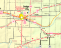
A 2005 map showing the different areas of Ford County.

See also
 In Spanish: Condado de Ford (Kansas) para niños
