Bucklin, Kansas facts for kids
Quick facts for kids
Bucklin, Kansas
|
|
|---|---|

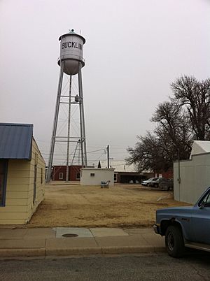
Water tower in Bucklin (2011)
|
|

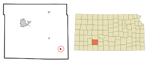
Location within Ford County and Kansas
|
|

|
|
| Country | United States |
| State | Kansas |
| County | Ford |
| Township | Bucklin |
| Founded | 1880s |
| Platted | 1885 (Corbitt) |
| Incorporated | 1909 (Bucklin) |
| Named for | Bucklin Township |
| Area | |
| • Total | 0.60 sq mi (1.56 km2) |
| • Land | 0.57 sq mi (1.49 km2) |
| • Water | 0.03 sq mi (0.07 km2) |
| Elevation | 2,415 ft (736 m) |
| Population
(2020)
|
|
| • Total | 727 |
| • Density | 1,212/sq mi (466.0/km2) |
| Time zone | UTC-6 (CST) |
| • Summer (DST) | UTC-5 (CDT) |
| ZIP code |
67834
|
| Area code | 620 |
| FIPS code | 20-09000 |
| GNIS ID | 2393449 |
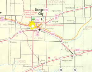
Bucklin is a small city located in Ford County, Kansas, in the United States. In 2020, about 727 people lived there. You can find Bucklin along U.S. Route 54, a major highway.
Contents
History of Bucklin
The area where Bucklin is now was first planned out around 1885. It was originally called Corbitt.
In 1887, the community's name was changed to Bucklin. It was named after Bucklin Township.
Bucklin officially became an incorporated city in 1909. This means it got its own local government. The city was also an important spot because two railroad lines met there.
Geography and Climate
Where is Bucklin Located?
Bucklin covers a total area of about 0.59 square miles (1.53 square kilometers). Most of this area is land, with a very small part being water.
Bucklin's Climate
The weather in Bucklin has hot and humid summers. The winters are usually mild to cool. This type of weather is known as a humid subtropical climate. On climate maps, it is often shown as "Cfa".
Population and People
| Historical population | |||
|---|---|---|---|
| Census | Pop. | %± | |
| 1910 | 696 | — | |
| 1920 | 835 | 20.0% | |
| 1930 | 917 | 9.8% | |
| 1940 | 832 | −9.3% | |
| 1950 | 824 | −1.0% | |
| 1960 | 752 | −8.7% | |
| 1970 | 771 | 2.5% | |
| 1980 | 786 | 1.9% | |
| 1990 | 710 | −9.7% | |
| 2000 | 725 | 2.1% | |
| 2010 | 794 | 9.5% | |
| 2020 | 727 | −8.4% | |
| U.S. Decennial Census | |||
Bucklin's Population in 2020
The 2020 United States census counted 727 people living in Bucklin. There were 284 households, which are groups of people living together. About 188 of these were families.
Most of the people in Bucklin, about 89.8%, were white. About 6.6% of the population identified as Hispanic or Latino.
About 32.4% of households had children under 18. Many households, 51.1%, were married couples. The average household had 2.1 people.
The median age in Bucklin was 41.3 years old. This means half the people were younger and half were older than 41.3. About 28.7% of the population was under 18 years old.
Bucklin's Population in 2010
In the census of 2010, Bucklin had 794 people. There were 287 households and 204 families.
The population density was about 1,418 people per square mile. Most residents, 93.3%, were white. About 4.0% of the population was Hispanic or Latino.
About 39.0% of households had children under 18. The average household size was 2.64 people.
The median age in 2010 was 35 years. About 30.4% of people were under 18.
Education in Bucklin
Students in Bucklin attend schools in the Bucklin USD 459 public school district.
The Bucklin Red Aces, which is the name for the school's sports teams, have won several state championships:
- In 1966, the Boys Cross Country team won the Class B championship.
- In 1973, the Boys Track & Field team won the Class 1A championship.
- Also in 1973, the Boys Track & Field (Indoor) team won the Class 1A championship.
- In 1980, the Boys Track & Field team won the Class 1A championship again.
Notable Person
- Eddie Sutton was a famous men's college basketball coach who came from Bucklin.
See also
 In Spanish: Bucklin (Kansas) para niños
 | Laphonza Butler |
 | Daisy Bates |
 | Elizabeth Piper Ensley |

