Clark County, Kansas facts for kids
Quick facts for kids
Clark County
|
|
|---|---|

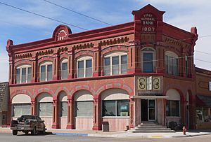
Stockgrowers State Bank in Ashland (2016)
|
|

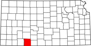
Location within the U.S. state of Kansas
|
|
 Kansas's location within the U.S. |
|
| Country | |
| State | |
| Founded | February 26, 1867 |
| Named for | Charles F. Clarke |
| Seat | Ashland |
| Largest city | Ashland |
| Area | |
| • Total | 977 sq mi (2,530 km2) |
| • Land | 975 sq mi (2,530 km2) |
| • Water | 2.6 sq mi (7 km2) 0.3%% |
| Population
(2020)
|
|
| • Total | 1,991 |
| • Estimate
(2021)
|
1,977 |
| • Density | 2.0/sq mi (0.8/km2) |
| Time zone | UTC−6 (Central) |
| • Summer (DST) | UTC−5 (CDT) |
| Area code | 620 |
| Congressional district | 1st |
Clark County is a county located in the state of Kansas, USA. Its main city and county seat is Ashland. As of the 2020 census, about 1,991 people lived here. The county was named after Charles Clarke.
Contents
History of Clark County
For thousands of years, the Great Plains of North America were home to nomadic Native American tribes.
In 1854, the Kansas Territory was formed. Then, in 1861, Kansas became the 34th U.S. state.
Clark County was officially established in 1867.
Geography of Clark County
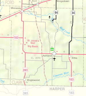
Clark County covers a total area of about 977 square miles. Most of this area is land (975 square miles), with a small amount of water (2.6 square miles).
Neighboring Counties
Clark County shares borders with several other counties:
- Ford County (to the north)
- Kiowa County (to the northeast)
- Comanche County (to the east)
- Harper County, Oklahoma (to the southeast)
- Beaver County, Oklahoma (to the southwest)
- Meade County (to the west)
Main Roads
These are the major highways that run through Clark County:
- U.S. Route 54
- U.S. Route 160
- U.S. Route 183
- U.S. Route 283
- Kansas Highway 34
Population in Clark County
| Historical population | |||
|---|---|---|---|
| Census | Pop. | %± | |
| 1880 | 163 | — | |
| 1890 | 2,357 | 1,346.0% | |
| 1900 | 1,701 | −27.8% | |
| 1910 | 4,093 | 140.6% | |
| 1920 | 4,989 | 21.9% | |
| 1930 | 4,796 | −3.9% | |
| 1940 | 4,081 | −14.9% | |
| 1950 | 3,946 | −3.3% | |
| 1960 | 3,396 | −13.9% | |
| 1970 | 2,896 | −14.7% | |
| 1980 | 2,599 | −10.3% | |
| 1990 | 2,418 | −7.0% | |
| 2000 | 2,390 | −1.2% | |
| 2010 | 2,215 | −7.3% | |
| 2020 | 1,991 | −10.1% | |
| 2023 (est.) | 1,847 | −16.6% | |
| U.S. Decennial Census 1790-1960 1900-1990 1990-2000 2010-2020 |
|||
According to the census in 2000, Clark County had 2,390 people living there. The population density was about 2 people per square mile.
The average age of people in the county was 42 years old. About 26.6% of the population was under 18 years old.
Education in Clark County
Clark County has two main school districts that serve its students:
Unified School Districts
- Minneola USD 219
- Ashland USD 220
Communities in Clark County
Clark County is made up of several cities and smaller communities.
Cities
- Ashland (This is the county seat, meaning it's where the county government is located)
- Englewood
- Minneola
Unincorporated Communities
These are smaller places that are not officially organized as cities:
- Acres
- Letitia
- Sitka
Ghost Towns
These are places that used to be communities but are now abandoned:
- Appleton
- Cash City
- Lexington
- Vanham
See also
 In Spanish: Condado de Clark (Kansas) para niños
 | Emma Amos |
 | Edward Mitchell Bannister |
 | Larry D. Alexander |
 | Ernie Barnes |


