
Beaver County, Oklahoma facts for kids
Quick facts for kids
Beaver County
|
|
|---|---|

Rural Beaver County (2011)
|
|

Location within the U.S. state of Oklahoma
|
|
 Oklahoma's location within the U.S. |
|
| Country | |
| State | |
| Founded | 1890 |
| Seat | Beaver |
| Largest town | Beaver |
| Area | |
| • Total | 1,818 sq mi (4,710 km2) |
| • Land | 1,815 sq mi (4,700 km2) |
| • Water | 2.8 sq mi (7 km2) 0.2%% |
| Population
(2020)
|
|
| • Total | 5,049 |
| • Density | 3.1/sq mi (1.2/km2) |
| Time zone | UTC−6 (Central) |
| • Summer (DST) | UTC−5 (CDT) |
| Congressional district | 3rd |
Beaver County is a county in the state of Oklahoma. In 2020, about 5,049 people lived there. The main town and county seat is Beaver. The county got its name from the many beaver dams found on the Beaver River. This river flows through the area. Beaver County is part of the Oklahoma Panhandle, which is the narrow strip of land in the northwest corner of the state.
Contents
- A Look Back: History of Beaver County
- Exploring Beaver County's Geography
- People of Beaver County: Demographics
- Beaver County's Economy: How People Make a Living
- Towns and Communities in Beaver County
- Fun and Recreation in Beaver County
- Important Places: National Register of Historic Places
- Images for kids
- See also
A Look Back: History of Beaver County
The land that is now Beaver County has a long and interesting past. It was once part of Mexico and then Texas. After Texas became a U.S. state, it gave this land to the United States government in 1850.
From "No Man's Land" to Oklahoma Territory
For a while, this area was known as "No Man's Land." This meant it didn't belong to any state or territory. It was like a forgotten place! From 1886 to 1890, it was even its own territory called Cimarron Territory.
In 1890, it became part of the Oklahoma Territory. At first, Beaver County (then called Seventh County) covered the entire Oklahoma Panhandle. But when Oklahoma officially became a state in 1907, the Panhandle was divided. Cimarron County was created in the west, and Texas County was formed in the middle. This left Beaver County in the eastern part of the Panhandle.
Today, Beaver County's borders are set. They are at 100°W to the east, 37°N to the north, 36.5°N to the south, and about 100.8°W to the west.
Exploring Beaver County's Geography
Beaver County is a large area. It covers about 1,818 square miles. Most of this is land (1,815 square miles), with a small amount of water (2.8 square miles). It is the fifth-largest county in Oklahoma by size.
Just north of the town of Beaver, you can find the Beaver Dunes Park. This park is known for its sandy dunes.
Main Roads in Beaver County
Several important highways run through Beaver County, making it easy to travel around.
 U.S. Highway 64
 U.S. Highway 83
 U.S. Highway 270
 U.S. Highway 412
 State Highway 3
 State Highway 23
Neighboring Counties and States
Beaver County shares its borders with several other counties and states.
- Meade County, Kansas (north)
- Clark County, Kansas (northeast)
- Harper County (east)
- Ellis County (southeast)
- Lipscomb County, Texas (south)
- Ochiltree County, Texas (southwest)
- Texas County (west)
- Seward County, Kansas (northwest)
People of Beaver County: Demographics
| Historical population | |||
|---|---|---|---|
| Census | Pop. | %± | |
| 1900 | 3,051 | — | |
| 1910 | 13,631 | 346.8% | |
| 1920 | 14,048 | 3.1% | |
| 1930 | 11,452 | −18.5% | |
| 1940 | 8,648 | −24.5% | |
| 1950 | 7,411 | −14.3% | |
| 1960 | 6,965 | −6.0% | |
| 1970 | 6,282 | −9.8% | |
| 1980 | 6,806 | 8.3% | |
| 1990 | 6,023 | −11.5% | |
| 2000 | 5,857 | −2.8% | |
| 2010 | 5,636 | −3.8% | |
| 2020 | 5,049 | −10.4% | |
| 2021 (est.) | 4,980 | −11.6% | |
| U.S. Decennial Census 1790-1960 1900-1990 1990-2000 2010 |
|||

In 2010, about 5,636 people lived in Beaver County. There were 2,192 households, which are groups of people living together. The average number of people in each household was about 2.57.
The population includes people of all ages. In 2010, about 26.8% of the people were under 18 years old. About 16.9% were 65 years old or older. The median age, which is the middle age of all people, was 39 years.
Beaver County's Economy: How People Make a Living
Since the early 1900s, the economy of Beaver County has mostly been about agriculture. This means farming and raising animals.
Farming and Railroads
At first, a plant called broomcorn was the main crop grown here. But by the 1920s, wheat became the most important crop.
Railroads played a big part in the county's growth. They helped farmers get their crops to markets. This also brought many new farmers to the area. For example, the Wichita Falls and Northwestern Railway built a line through the county starting in 1912. Later, the Beaver, Meade and Englewood Railroad added more lines. New towns even grew up along these railroad routes.
Towns and Communities in Beaver County
Beaver County has several towns and smaller communities where people live.
Towns
Census-Designated Places (CDPs)
These are areas that are like towns but are not officially incorporated.
- Little Ponderosa
- Turpin
Other Small Communities
Ghost Towns
- Cline (This town no longer exists)
Fun and Recreation in Beaver County
The Beaver River Wildlife Management Area is a great place for outdoor activities. It covers about 17,700 acres. Here, you can enjoy:
- Watching wildlife
- Hunting
- Fishing
- Boating
- Swimming
Important Places: National Register of Historic Places
Several places in Beaver County are listed on the National Register of Historic Places. This means they are important historical sites that are protected.
|
|
Images for kids
-
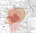
Area affected by the 1930s Dust Bowl
.svg)
See also
 In Spanish: Condado de Beaver (Oklahoma) para niños
