Beaver, Oklahoma facts for kids
Quick facts for kids
Beaver, Oklahoma
|
|
|---|---|
| Nickname(s):
"Cowchip Throwing Capital of The World"
|
|
| Motto(s):
"No Man's Land – Every Man's Town"
|
|

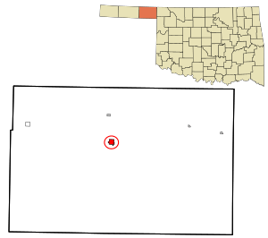
Location within Beaver County and Oklahoma
|
|
| Country | United States |
| State | Oklahoma |
| County | Beaver |
| Area | |
| • Total | 1.15 sq mi (2.97 km2) |
| • Land | 1.15 sq mi (2.97 km2) |
| • Water | 0.00 sq mi (0.00 km2) |
| Elevation | 2,428 ft (740 m) |
| Population
(2020)
|
|
| • Total | 1,280 |
| • Density | 1,114.98/sq mi (430.34/km2) |
| Time zone | UTC-6 (Central (CST)) |
| • Summer (DST) | UTC-5 (CDT) |
| ZIP code |
73932
|
| Area code | 580 |
| FIPS code | 40-04750 |
| GNIS ID | 2411674 |
Beaver is a town in Beaver County, Oklahoma, United States. It is also the county seat, which means it's where the main government offices for the county are located. The town is found in the Oklahoma Panhandle, a narrow strip of land in the northwest part of the state.
In 2020, about 1,280 people lived in Beaver. The town is famous for hosting the annual World Cow Chip Throwing Championship. This fun event happens every April and includes a parade, a carnival, and, of course, cow chip throwing contests! It brings a lot of attention from nearby towns.
Contents
History of Beaver
Beaver started as a place for fur-trading in 1879, located by the Beaver River. It was first called Beaver City. People even thought it might become the capital of a new area called the Cimarron Territory.
The United States government never officially recognized this territory. However, Beaver City still became an important center for business and law enforcement. In 1890, the area became part of the Oklahoma Territory. Beaver City then became the main town for the entire Oklahoma Panhandle, which was known as Seventh County back then.
How Beaver Grew
Beaver began as a stop along the Jones and Plummer Trail, a path used by traders. In 1880, a man named Jim Lane built a house that served as a general store, a place to eat, and even a hotel. Beaver slowly grew along the banks of Beaver Creek.
The first post office opened in 1883. Jim Lane later moved it to his store in 1884 and became the postmaster. He also added a place for horses and wagons, which helped people traveling through. The Presbyterian Church was built in 1887. It is known as the oldest church in the Oklahoma Territory.
The town faced a challenge early on when a flash flood hit Main Street. Many businesses had to move to a higher street called Douglas to avoid future floods.
Growth and Challenges
By 1900, Beaver had 112 people. Its main purpose was to support the many cattle ranches in the Panhandle. From 1901 to 1902, the Homestead Act encouraged farmers to move to the area. This helped the town grow even more.
A telephone system was set up in 1905. Two banks, the Bank of Beaver City and the First National Bank, were also started. A railroad, the Beaver, Meade and Englewood Railroad (BME), was built to connect Beaver to another railroad in Forgan, about 7 miles (11 km) north. The BME line was finished in 1915. Later, a bigger railroad company bought the BME system.
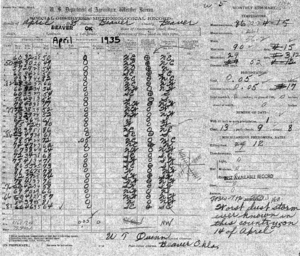
During the Dust Bowl and the Great Depression in the 1930s, many towns in the Panhandle struggled. But Beaver actually grew! Its population increased from 920 in 1920 to 1,166 in 1940.
Geography and Climate
Beaver covers about 1.1 square miles (2.97 square kilometers) of land.
Just a mile north of town is Beaver Dunes Park. This park has sand dunes that were left behind by ancient seas that once covered the area. It's now owned by the City of Beaver.
Weather in Beaver
Beaver has a semi-arid climate. This means it has cool, dry winters and hot, much wetter summers.
Even though it doesn't get the most snow in Oklahoma every year, Beaver holds the state record for the most snowfall in one season. It received 87.3 inches (221.7 cm) of snow during the winter of 1911–1912!
| Climate data for Beaver, OK | |||||||||||||
|---|---|---|---|---|---|---|---|---|---|---|---|---|---|
| Month | Jan | Feb | Mar | Apr | May | Jun | Jul | Aug | Sep | Oct | Nov | Dec | Year |
| Record high °F (°C) | 82 (28) |
89 (32) |
94 (34) |
102 (39) |
108 (42) |
113 (45) |
110 (43) |
110 (43) |
108 (42) |
99 (37) |
89 (32) |
87 (31) |
113 (45) |
| Mean daily maximum °F (°C) | 46.0 (7.8) |
52.3 (11.3) |
60.7 (15.9) |
70.8 (21.6) |
78.9 (26.1) |
89.1 (31.7) |
95.1 (35.1) |
93.2 (34.0) |
84.8 (29.3) |
73.8 (23.2) |
58.7 (14.8) |
48.3 (9.1) |
71.0 (21.7) |
| Daily mean °F (°C) | 31.8 (−0.1) |
37.2 (2.9) |
45.5 (7.5) |
55.3 (12.9) |
64.8 (18.2) |
75.0 (23.9) |
80.7 (27.1) |
79.0 (26.1) |
70.1 (21.2) |
57.8 (14.3) |
43.6 (6.4) |
34.0 (1.1) |
56.2 (13.5) |
| Mean daily minimum °F (°C) | 17.5 (−8.1) |
22.0 (−5.6) |
30.3 (−0.9) |
39.7 (4.3) |
50.7 (10.4) |
60.8 (16.0) |
66.2 (19.0) |
64.7 (18.2) |
55.4 (13.0) |
41.8 (5.4) |
28.4 (−2.0) |
19.7 (−6.8) |
41.4 (5.2) |
| Record low °F (°C) | −23 (−31) |
−19 (−28) |
−10 (−23) |
15 (−9) |
26 (−3) |
41 (5) |
46 (8) |
45 (7) |
27 (−3) |
13 (−11) |
−6 (−21) |
−13 (−25) |
−23 (−31) |
| Average precipitation inches (mm) | 0.53 (13) |
0.73 (19) |
1.75 (44) |
1.82 (46) |
3.04 (77) |
3.24 (82) |
2.75 (70) |
2.39 (61) |
1.78 (45) |
1.32 (34) |
1.11 (28) |
0.78 (20) |
21.24 (539) |
| Source 1: NOAA (normals, 1971–2000) | |||||||||||||
| Source 2: The Weather Channel (Records) | |||||||||||||
People of Beaver
| Historical population | |||
|---|---|---|---|
| Census | Pop. | %± | |
| 1900 | 112 | — | |
| 1910 | 326 | 191.1% | |
| 1920 | 920 | 182.2% | |
| 1930 | 1,028 | 11.7% | |
| 1940 | 1,166 | 13.4% | |
| 1950 | 1,495 | 28.2% | |
| 1960 | 2,087 | 39.6% | |
| 1970 | 1,853 | −11.2% | |
| 1980 | 1,939 | 4.6% | |
| 1990 | 1,584 | −18.3% | |
| 2000 | 1,570 | −0.9% | |
| 2010 | 1,515 | −3.5% | |
| 2020 | 1,280 | −15.5% | |
| U.S. Decennial Census | |||
In 2010, there were 1,515 people living in Beaver. The town had about 1,300 people per square mile. Most people living in Beaver were White (92.48%). About 9.68% of the population was Hispanic or Latino.
There were 606 households in Beaver. About 32.2% of these households had children under 18 living with them. The average household had 2.43 people. The average age of people in Beaver was 39 years old.
Beaver's Economy
At the start of the 2000s, Beaver's economy mainly relied on a few key areas:
- Ranching and Farming: Raising cattle and hogs, and growing crops like wheat.
- Oil and Gas: Producing oil and natural gas from the ground.
To support these industries, Beaver had businesses like banks, suppliers for oil fields, a hospital, a nursing home, and medical clinics.
Education in Beaver
Students in Beaver attend schools that are part of the Beaver Independent School District.
Getting Around Beaver
Roads
U.S. Route 270 and State Highway 23 both pass through Beaver, running north and south.
Airport
The Beaver Municipal Airport is located at the south end of town. It has two runways. One is paved with asphalt and is 4,050 feet (1,234 meters) long. The other is a grass runway, 2,000 feet (610 meters) long. These runways are mainly used for small, private planes. For bigger commercial flights, the closest airport is the Liberal Mid-America Regional Airport in Liberal, Kansas, which is about 38 miles (61 km) away.
Historical Places to Visit
The Jones & Plummer Trail Museum lets you see what life was like in Beaver's early days. It has old items and rooms set up like they used to be.
Several places in Beaver are listed on the National Register of Historic Places. This means they are important historical sites that are protected. These include:
- The Beaver County Courthouse
- The Presbyterian Church
- The Lane Cabin, located at Main Street and Avenue C
Famous People from Beaver
- Nick Bobeck (born 1980), a football player and coach.
- George Dobson (1851–1919), a lawyer and politician.
- Timothy Leonard (born 1940), a United States federal judge.
- Robert Loofbourrow (1873–1926), an early settler, lawyer, and judge.
- Ross Rizley (1892–1969), a politician who served in the U.S. House of Representatives.
See also
 In Spanish: Beaver (Oklahoma) para niños
 | Roy Wilkins |
 | John Lewis |
 | Linda Carol Brown |


