Bloom, Kansas facts for kids
Quick facts for kids
Bloom, Kansas
|
|
|---|---|

|
|
| Country | United States |
| State | Kansas |
| County | Ford |
| Founded | 1880s |
| Named for | Bloomsburg, Pennsylvania |
| Elevation | 2,585 ft (788 m) |
| Time zone | UTC-6 (CST) |
| • Summer (DST) | UTC-5 (CDT) |
| Area code | 620 |
| FIPS code | 20-07350 |
| GNIS ID | 470693 |
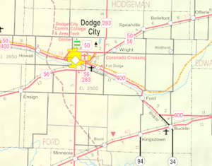
Bloom is a small, unincorporated community located in Ford County, Kansas, United States. This means it's a place where people live, but it doesn't have its own local government like a city or town. In 2018, about 94 people called Bloom home. You can find Bloom right along U.S. Route 54, a major highway. The local post office in Bloom closed its doors in 1992.
How Bloom Started
Bloom was founded by two people, Thomas J. Vanderslice and Samuel O. Albright. This happened around 1887 or 1888. Mr. Vanderslice gave the community its name, Bloom. He named it after his own hometown, which was Bloomsburg, Pennsylvania.
The community began to grow when the Rock Island Railroad built its tracks through the area. The original train station from those early days can still be seen in Bloom today.
Bloom's Changing Population
In the 1930s, Bloom had a population of a few hundred people. However, the number of residents has slowly gone down since then. Today, fewer than 50 people live there.
The local school, Bloom High School, closed in 1964. This happened when Bloom's school district joined with the district in Minneola, Kansas.
What You Find in Bloom
Long ago, Bloom was a busier place. It used to have a hotel, a gas station, and even a restaurant. There was also a post office and a lumber yard.
Today, most of those businesses are gone. Now, you will mostly find a grain elevator business. This is where farmers store their crops. There are also private homes where people live. The area around Bloom is mostly made up of large wheat farms and ranches.
People in Bloom
According to an estimate from 2018, Bloom, Kansas, has a population of 94 people. The same estimate found that there were 37 households in the community. On average, about 2.5 people lived in each household. The average age of people in Bloom was estimated to be around 35.8 years old.
 | George Robert Carruthers |
 | Patricia Bath |
 | Jan Ernst Matzeliger |
 | Alexander Miles |


