
Yarkand River facts for kids
Quick facts for kids Yarkand River |
|
|---|---|

Yarkand River
|
|

|
|
| Country | China |
| Province | Xinjiang |
| Physical characteristics | |
| Main source | North Siachen Muztagh, Karakoram range at an Altitude of 7,462 m (24,482 ft) 35°32′53″N 77°28′58″E / 35.547983°N 77.482907°E |
| 2nd source | East Siachen Muztagh, North Rimo Glacier 35°29′17″N 77°26′52″E / 35.488°N 77.4479°E |
| 3rd source | Karakoram_Pass 5539 units? 35°30′48″N 77°49′22″E / 35.51346°N 77.8227°E |
| River mouth | Tarim River or Neinejoung River 38°25′00″N 77°21′36″E / 38.416667°N 77.36°E |
| Length | 1,332.25 km (827.82 mi) |
| Basin features | |
| Progression | Tarim→ Taitema Lake |
| Basin size | 98,900 km2 (38,200 sq mi) |
| Landmarks | Yarkand |
| Tributaries |
|
| Waterbodies | Altash Water Conservancy Project (Midstream Reservoir) |
| Yarkand River | |||||||||||
|---|---|---|---|---|---|---|---|---|---|---|---|
| Uyghur name | |||||||||||
| Uyghur | يەكەن دەرياسى | ||||||||||
|
|||||||||||
| Chinese name | |||||||||||
| Traditional Chinese | 葉爾羌河 | ||||||||||
| Simplified Chinese | 叶尔羌河 | ||||||||||
|
|||||||||||
The Yarkand River is a long river in western China. It starts high up in the Karakoram mountains. This mountain range is located in the Xinjiang Uyghur Autonomous Region. The river flows for about 1,332.25 km (827.82 mi). That's like driving from New York City to Chicago and back!
The Yarkand River used to flow into the Tarim River. However, today, most of its water is used before it can reach the Tarim River. It now mostly flows into a place called the Midstream Reservoir. The river is also known by other names, like Raskam River or Zarafshan.
Where Does the Yarkand River Flow?
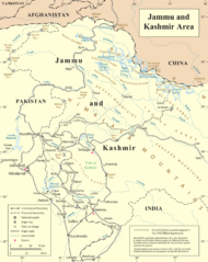
The Yarkand River begins in the Siachen Muztagh area of the Karakoram mountains. This is near the border between India and China. It starts by flowing north. Then, it turns northwest. Along the way, it collects water from other rivers, like the Shaksgam River. The Shaksgam River gets its water from many glaciers in the Karakoram mountains.
As the Yarkand River continues north, it flows through the Bolor-Tagh mountains. It then meets the Tashkurgan River. A large dam called the Aratax dam was built on the Yarkand River in 2019. This dam helps control floods, provides water for farms, and creates electricity.
After the dam, the river turns northeast. It enters the Tarim Basin, which is a large area of land. Here, the river creates a rich oasis, which is a fertile area in a desert. This oasis provides water for the Yarkant county. Further northeast, the Yarkand River receives water from the Kashgar River. Finally, it flows into the Shangyou Reservoir.
Over the years, more and more water from the Yarkand River has been used. This means less water reaches the Tarim River. For example, between 1986 and 2000, the Yarkand River only flowed into the Tarim River once. The river's water is very important for irrigating (watering) farms in many counties, including Taxkorgan, Yecheng, and Yarkand.
History of the Yarkand River
The Yarkand River valley was once a very important part of the ancient Silk Road. The Silk Road was a network of trade routes that connected China with the West. It was used to transport goods like silk, spices, and other valuable items.
One path of the Silk Road followed the Yarkand River valley. Travelers would go from Aksu to the city of Yarkand. From Yarkand, the route crossed the Bolor-Tagh mountains. It followed the valleys of the Yarkand and Tashkurgan rivers to reach the town of Tashkurgan.
From Tashkurgan, traders would cross the Karakoram mountains through high passes. These passes led to places like Gilgit in northern Kashmir. From there, the route continued to Gandhara, which is near modern-day Peshawar.
Indian merchants brought the Kharosthi writing system to the Tarim Basin using this route. Buddhist monks also followed, spreading the religion of Buddhism. A famous Chinese Buddhist traveler named Fa Xian is thought to have used this very route.
Later, around 651 AD, the main Silk Road to western Asia was blocked. This made the southern route through the Yarkand River valley even more important. China even invaded Gilgit in 747 AD to protect its trade routes. Over time, other trade routes also developed, connecting Yarkand to Ladakh.
Gallery
-
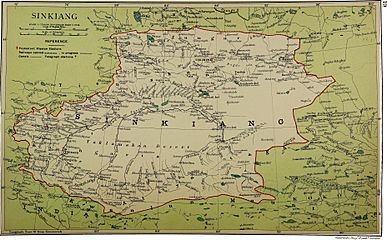
Map including Zerafshan R. and Raskem daria (1917)
-
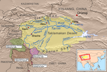
Rivers of the Tarim Basin
-
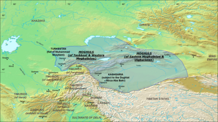
Moghulistan (Chagatai Khanate), 1490 AD
-
Map including part of the Yarkand River (labeled as YĀRKAND RIVER) (AMS, 1955)
-
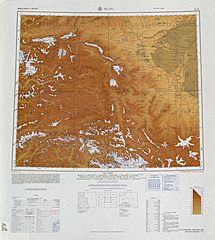
Map including the Yarkand River (labeled as Yeh-erh-ch'iang Ho) and surrounding region from the International Map of the World (AMS, 1966)
-
Map including part of the Yarkand River (Yeh-erh-ch'iang Ho) (ACIC, 1969)
-
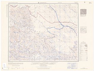
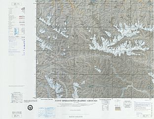
Map including the upper reaches of the Yarkand River
-
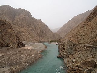
Yarkand River
-
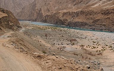
Sheep on the bank of the Yarkand River
-
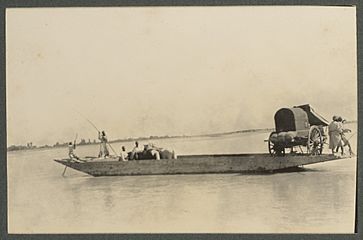
Ferry on the Yarkand River (1915)
-
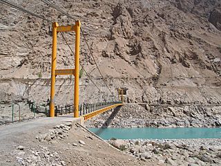
Langar Bridge (兰干桥) on the Yarkand River
_p61_PLATE19._SINKIANG_(14597194848).jpg)

.png)


See also
 In Spanish: Río Yarkand para niños
