
Yates Center, Kansas facts for kids
Quick facts for kids
Yates Center, Kansas
|
|
|---|---|
|
City and County seat
|
|

Woodson County Courthouse (2017)
|
|

Location within Woodson County and Kansas
|
|

|
|
| Country | United States |
| State | Kansas |
| County | Woodson |
| Founded | 1875 |
| Incorporated | 1884 |
| Area | |
| • Total | 3.09 sq mi (8.01 km2) |
| • Land | 2.66 sq mi (6.89 km2) |
| • Water | 0.43 sq mi (1.12 km2) |
| Elevation | 1,093 ft (333 m) |
| Population
(2020)
|
|
| • Total | 1,352 |
| • Density | 437.5/sq mi (168.79/km2) |
| Time zone | UTC-6 (CST) |
| • Summer (DST) | UTC-5 (CDT) |
| ZIP code |
66783
|
| Area code | 620 |
| FIPS code | 20-80700 |
| GNIS ID | 485664 |
Yates Center is a city in Kansas, United States. It is the main town, or "county seat," of Woodson County. In 2020, about 1,352 people lived there.
Contents
A Look at Yates Center's Past
Yates Center started in August 1875. It's named after Abner Yates. He owned the land and gave away a lot of it! He donated land for the courthouse, churches, a city park, and even gave a free plot of land to the first two babies born in town. Yates Center is special because it was chosen as a county seat before anyone even lived there.
Many buildings in downtown Yates Center are part of the Yates Center Courthouse Square Historic District. This means they are important old buildings.
Where is Yates Center?
Yates Center covers about 3.05 square miles (7.9 square kilometers). Most of this area is land, with a small part being water.
Weather in Yates Center
The weather in Yates Center has hot, humid summers. Winters are usually mild to cool. This type of weather is called a humid subtropical climate.
| Climate data for Yates Center, Kansas, 1991–2020 normals, extremes 1893–present | |||||||||||||
|---|---|---|---|---|---|---|---|---|---|---|---|---|---|
| Month | Jan | Feb | Mar | Apr | May | Jun | Jul | Aug | Sep | Oct | Nov | Dec | Year |
| Record high °F (°C) | 77 (25) |
87 (31) |
95 (35) |
96 (36) |
102 (39) |
108 (42) |
111 (44) |
111 (44) |
108 (42) |
98 (37) |
93 (34) |
79 (26) |
111 (44) |
| Mean maximum °F (°C) | 66.6 (19.2) |
71.0 (21.7) |
79.3 (26.3) |
83.8 (28.8) |
87.7 (30.9) |
92.8 (33.8) |
98.4 (36.9) |
98.8 (37.1) |
94.3 (34.6) |
85.9 (29.9) |
74.8 (23.8) |
66.9 (19.4) |
100.2 (37.9) |
| Mean daily maximum °F (°C) | 42.0 (5.6) |
47.4 (8.6) |
57.3 (14.1) |
66.9 (19.4) |
75.2 (24.0) |
84.6 (29.2) |
89.3 (31.8) |
88.8 (31.6) |
81.2 (27.3) |
69.6 (20.9) |
56.8 (13.8) |
45.1 (7.3) |
67.0 (19.5) |
| Daily mean °F (°C) | 31.3 (−0.4) |
35.8 (2.1) |
45.2 (7.3) |
55.0 (12.8) |
64.8 (18.2) |
74.2 (23.4) |
78.8 (26.0) |
77.6 (25.3) |
69.5 (20.8) |
57.8 (14.3) |
45.4 (7.4) |
34.9 (1.6) |
55.9 (13.2) |
| Mean daily minimum °F (°C) | 20.6 (−6.3) |
24.2 (−4.3) |
33.1 (0.6) |
43.2 (6.2) |
54.5 (12.5) |
63.9 (17.7) |
68.3 (20.2) |
66.3 (19.1) |
57.9 (14.4) |
46.0 (7.8) |
33.9 (1.1) |
24.6 (−4.1) |
44.7 (7.1) |
| Mean minimum °F (°C) | 3.0 (−16.1) |
7.9 (−13.4) |
15.9 (−8.9) |
27.9 (−2.3) |
40.7 (4.8) |
54.1 (12.3) |
59.3 (15.2) |
56.4 (13.6) |
44.3 (6.8) |
29.9 (−1.2) |
18.3 (−7.6) |
8.0 (−13.3) |
−0.6 (−18.1) |
| Record low °F (°C) | −21 (−29) |
−28 (−33) |
−4 (−20) |
8 (−13) |
24 (−4) |
39 (4) |
45 (7) |
44 (7) |
28 (−2) |
13 (−11) |
−1 (−18) |
−20 (−29) |
−28 (−33) |
| Average precipitation inches (mm) | 1.07 (27) |
1.63 (41) |
2.67 (68) |
4.12 (105) |
5.89 (150) |
5.47 (139) |
5.04 (128) |
3.75 (95) |
4.37 (111) |
3.73 (95) |
2.26 (57) |
1.81 (46) |
41.81 (1,062) |
| Average snowfall inches (cm) | 3.1 (7.9) |
1.8 (4.6) |
1.0 (2.5) |
0.0 (0.0) |
0.0 (0.0) |
0.0 (0.0) |
0.0 (0.0) |
0.0 (0.0) |
0.0 (0.0) |
0.2 (0.51) |
0.6 (1.5) |
2.3 (5.8) |
9.0 (23) |
| Average precipitation days (≥ 0.01 in) | 4.2 | 4.9 | 6.7 | 8.5 | 10.0 | 8.2 | 7.6 | 7.3 | 6.7 | 6.9 | 5.4 | 4.8 | 81.2 |
| Average snowy days (≥ 0.1 in) | 2.0 | 1.0 | 0.6 | 0.0 | 0.0 | 0.0 | 0.0 | 0.0 | 0.0 | 0.1 | 0.4 | 1.4 | 5.5 |
| Source 1: NOAA | |||||||||||||
| Source 2: National Weather Service | |||||||||||||
Who Lives in Yates Center?
| Historical population | |||
|---|---|---|---|
| Census | Pop. | %± | |
| 1880 | 350 | — | |
| 1890 | 1,305 | 272.9% | |
| 1900 | 1,634 | 25.2% | |
| 1910 | 2,024 | 23.9% | |
| 1920 | 2,306 | 13.9% | |
| 1930 | 2,013 | −12.7% | |
| 1940 | 2,176 | 8.1% | |
| 1950 | 2,178 | 0.1% | |
| 1960 | 2,080 | −4.5% | |
| 1970 | 1,967 | −5.4% | |
| 1980 | 1,998 | 1.6% | |
| 1990 | 1,815 | −9.2% | |
| 2000 | 1,599 | −11.9% | |
| 2010 | 1,417 | −11.4% | |
| 2020 | 1,352 | −4.6% | |
| U.S. Decennial Census | |||
Population in 2010
In 2010, there were 1,417 people living in Yates Center. They lived in 664 homes. About 22.6% of these homes had children under 18. Many homes (39.5%) were married couples. About 41.9% of homes had just one person living there.
The average age in the city was 45.1 years old. About 21.2% of people were under 18. The city had slightly more females (53.1%) than males (46.9%).
Learning in Yates Center
The local public schools are part of the Woodson USD 366 school district. This district serves the community and helps students learn.
Images for kids
-
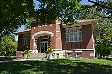
1912 Yates Center Carnegie Library
-
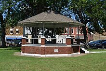
1928 Bandstand
-
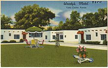
1930s postcard featuring Woody's Motel


.jpg)
See also
 In Spanish: Yates Center para niños
