Zamora, Ecuador facts for kids
Quick facts for kids
Zamora
|
||
|---|---|---|
|
City
|
||
| Zamora de los Alcaides | ||

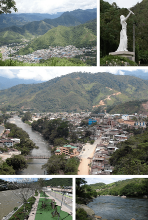
From top, left to right: Panoramic view of the city, monument to Naya or La Chapetona, downtown, Linear Park of Zamora and Bombuscaro river.
|
||
|
||
| Nickname(s):
City of Birds and Waterfalls
|
||
| Country | Ecuador | |
| Province | Zamora-Chincipe | |
| Canton | Zamora Canton | |
| Founded | October 4, 1549 | |
| Area | ||
| • City | 6.23 km2 (2.41 sq mi) | |
| Elevation | 970 m (3,180 ft) | |
| Population
(2022 census)
|
||
| • City | 17,584 | |
| • Density | 2,822.5/km2 (7,310/sq mi) | |
| Demonym(s) | Zamorano(-a) | |
| Time zone | UTC-5 (ECT) | |
| Climate | Af | |
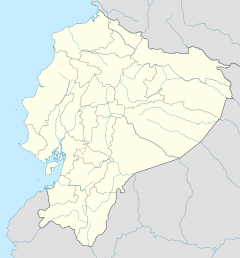
Zamora is a city in southeastern Ecuador. It is the capital of the Zamora-Chinchipe area. It is also the main and most populated city in this province.
The city is located in the Oriente region. This area is at the base of the eastern part of the Andes mountains. Zamora sits 970 meters (about 3,182 feet) above sea level.
Three rivers meet in Zamora: the Zamora, Bombuscaro, and Jamboé rivers.
About Zamora
Zamora has grown a lot recently. This is because gold was found nearby. The city is known as the "Mining Capital of Ecuador."
It is also called the "City of Birds and Waterfalls." This name comes from the many kinds of birds living there. It also refers to the beautiful waterfalls around the city.
Location and Travel
The city stretches from west to east towards Cumbaratza. You can travel to other towns and areas from Zamora. Many buses connect Zamora to other places.
See also
 In Spanish: Zamora (Ecuador) para niños
 | Frances Mary Albrier |
 | Whitney Young |
 | Muhammad Ali |


