Zamora-Chinchipe Province facts for kids
Quick facts for kids
Zamora Chinchipe
|
|||
|---|---|---|---|
| Province of Zamora Chinchipe | |||

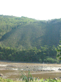
A picture of the Mayo River as it flows through the village of Solo
|
|||
|
|||

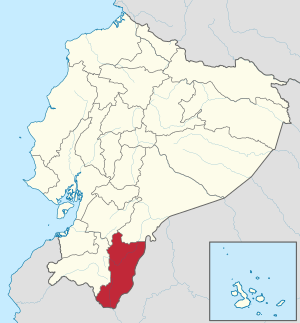
Location of Zamora Chinchipe in Ecuador
|
|||

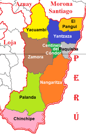
Cantons of Zamora Chinchipe Province
|
|||
| Country | |||
| Established | November 10, 1953 | ||
| Capital | Zamora | ||
| Cantons |
List of Cantons
Centinela del Cóndor
Chinchipe El Pangui Nangaritza Palanda Paquisha Yacuambi Yantzaza Zamora |
||
| Area | |||
| • Total | 10,584.28 km2 (4,086.61 sq mi) | ||
| Population
(2010 census)
|
|||
| • Total | 91,376 | ||
| • Density | 8.63318/km2 (22.35983/sq mi) | ||
| Time zone | UTC-05 (ECT) | ||
| Vehicle registration | Z | ||
| HDI (2017) | 0.694 medium · 24th |
||
Zamora Chinchipe is a beautiful province in the country of Ecuador. It is located in the southeastern part of the country. This area is known for being part of the amazing Amazon Basin. The main city and capital of this province is Zamora.
How Zamora Chinchipe is Organized
A province is like a large region or state within a country. Zamora Chinchipe is divided into smaller areas called cantons. Think of cantons as smaller districts or counties. Each canton has its own main town or capital city.
This table shows the different cantons in Zamora Chinchipe. It also lists how many people lived there in 2001 and how big each canton is.
| Canton | Population (2001) | Area (km²) | Main City |
|---|---|---|---|
| Centinela del Cóndor | 7,230 | 519 | Zumbi |
| Chinchipe | 8,495 | 1,194 | Zumba |
| El Pangui | 7,441 | 614 | El Pangui |
| Nangaritza | 4,797 | 2,096 | Guayzimi (Nangaritza) |
| Palanda | 7,066 | 1,925 | Palanda |
| Paquisha | Paquisha | ||
| Yacuambi | 5,229 | 1,242 | Yacuambi |
| Yantzaza | 14,552 | 990 | Yantzaza |
| Zamora | 21,791 | 1,876 | Zamora |
Images for kids
See also
 In Spanish: Provincia de Zamora Chinchipe para niños

All content from Kiddle encyclopedia articles (including the article images and facts) can be freely used under Attribution-ShareAlike license, unless stated otherwise. Cite this article:
Zamora-Chinchipe Province Facts for Kids. Kiddle Encyclopedia.


