
Zorita facts for kids
Quick facts for kids
Zorita, Spain
|
|||
|---|---|---|---|
|
municipality
|
|||

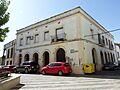
Town of Zorita
|
|||
|
|||

Map of Zorita
|
|||
| Country | Spain | ||
| Autonomous community | Extremadura | ||
| Province | Cáceres | ||
| Municipality | Zorita | ||
| Area | |||
| • Total | 186.96 km2 (72.19 sq mi) | ||
| Elevation | 423 m (1,388 ft) | ||
| Population
(2018)
|
|||
| • Total | 1,377 | ||
| • Density | 7.3652/km2 (19.076/sq mi) | ||
| Time zone | UTC+1 (CET) | ||
| • Summer (DST) | UTC+2 (CEST) | ||


Zorita is a small town in Spain. It is located in the province of Cáceres. This province is part of a larger region called Extremadura.
In 2006, about 1,768 people lived in Zorita. By 2018, the population was around 1,377.
Contents
Where is Zorita Located?
Zorita is found in the western part of Spain. It is in the Extremadura region, which borders Portugal. The town is part of the Cáceres province.
Geographical Features
Zorita sits at an elevation of 423 meters (about 1,388 feet) above sea level. This means it is located on higher ground. The total area of the municipality is about 186.96 square kilometers. That's roughly 72 square miles.
Population and People
The number of people living in Zorita has changed over time. In 2006, there were 1,768 residents. By 2018, this number had decreased to 1,377. The population density shows how many people live in each square kilometer of land.
Images for kids
-
Town of Zorita
See also
 In Spanish: Zorita (Cáceres) para niños
